
IMAGES TAKEN NEAR TO
West Lane, NORWICH, NR13 5RG
Introduction
This page details the photographs taken nearby to West Lane, NR13 5RG by members of the Geograph project.
The Geograph project started in 2005 with the aim of publishing, organising and preserving representative images for every square kilometre of Great Britain, Ireland and the Isle of Man.

There are currently over 7.5m images from over14,400 individuals and you can help contribute to the project by visiting https://www.geograph.org.uk
Image Map
Images are licensed for reuse under creativecommons.org/licenses/by-sa/2.0
Notes
- Clicking on the map will re-center to the selected point.
- The higher the marker number, the further away the image location is from the centre of the postcode.
Image Listing (30 Images Found)
Images are licensed for reuse under creativecommons.org/licenses/by-sa/2.0
Image
Details
Distance
1

Old Thatched House, Brundall Gardens Marina
This old house is in need of renovation!
Image: © Paul Shreeve
Taken: Unknown
0.06 miles
2

Brundall Gardens station - view west along the line
Brundall Gardens station > http://www.geograph.org.uk/photo/1531905 serves the western end of the village. It is located on the Wherry Lines and served by National Express East Anglia, linking Norwich with Great Yarmouth and Lowestoft. The entrance to the station is at the end of West End Avenue > http://www.geograph.org.uk/photo/1531874 - an unsurfaced access road serving the properties situated alongside it. The station is unmanned and there is no car park. A footbridge > http://www.geograph.org.uk/photo/1531893 connects the two platforms - it has the number 1225A.
Image: © Evelyn Simak
Taken: 12 Oct 2009
0.07 miles
3

Ruins of Restaurant, Brundall Gardens
For many years the ruin of this restaurant at Brundall Gardens were slowly decaying. The restaurant caught on fire (kitchen fire?) and the fire engines could not reach the site in time- the restaurant did not have its own pump to get water from the river!
Since this picture was taken, the ruins have been cleared away, leaving a nice lawn area.
Image: © Paul Shreeve
Taken: Unknown
0.07 miles
4

Brundal Gardens Railway station
The small railway stations with an attractive name. It's on the Wherry lines.
Photo taken while on the Lowestoft air show special hauled by DRS class 47 locomotives.
Image: © Ashley Dace
Taken: 23 Jul 2009
0.08 miles
5

New Marina, Greasehouse Reach, River Yare
A new marina, at Brundall Gardens, Greasehouse Reach, River Yare.
Image: © Paul Shreeve
Taken: Unknown
0.08 miles

7

Brundall Gardens station - footbridge
Brundall Gardens station > http://www.geograph.org.uk/photo/1531905 serves the western end of the village. It is located on the Wherry Lines and served by National Express East Anglia, linking Norwich with Great Yarmouth and Lowestoft. The entrance to the station is at the end of West End Avenue > http://www.geograph.org.uk/photo/1531874 - an unsurfaced access road serving the properties situated alongside it. The station is unmanned and there is no car park. A footbridge connects the two platforms - it has the number 1225A.
Image: © Evelyn Simak
Taken: 12 Oct 2009
0.09 miles
8
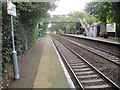
Brundall Gardens railway station, Norfolk
Opened in 1924 by the London & North Eastern Railway on the line from Yarmouth to Norwich.
View west towards Norwich.
Image: © Nigel Thompson
Taken: 1 Oct 2014
0.09 miles
9

Setting sail
yacht tacking up the River Yare at Brundall West Marina
Image: © Susan Currie
Taken: 8 Apr 2007
0.10 miles
10
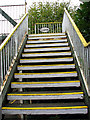
Brundall Gardens station - footbridge 1225A
For a full view of this footbridge see > http://www.geograph.org.uk/photo/1531893.
Image: © Evelyn Simak
Taken: 12 Oct 2009
0.11 miles