IMAGES TAKEN NEAR TO
Mallard Close, NORWICH, NR13 5PR

Introduction

This page details the photographs taken nearby to Mallard Close, NR13 5PR by members of the Geograph project.

The Geograph project started in 2005 with the aim of publishing, organising and preserving representative images for every square kilometre of Great Britain, Ireland and the Isle of Man.

There are currently over 7.5m images from over14,400 individuals and you can help contribute to the project by visiting https://www.geograph.org.uk

Image Map


Images are licensed for reuse under creativecommons.org/licenses/by-sa/2.0
Notes
  • Clicking on the map will re-center to the selected point.
  • The higher the marker number, the further away the image location is from the centre of the postcode.

Image Listing (96 Images Found)

Images are licensed for reuse under creativecommons.org/licenses/by-sa/2.0
  • ...
Image
Details
Distance
1
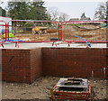
Houses under construction, Brundall
Image: © Hugh Venables Taken: 6 Aug 2016
0.07 miles
2
Housing development, Brundall
Image: © Hugh Venables Taken: 19 Dec 2015
0.07 miles
3
View from a Norwich-Great Yarmouth train - semaphore signals at Brundall Junction
Image: © Nigel Thompson Taken: 30 Jun 2016
0.11 miles
4
Brundall railway station - signal box
Brundall railway station > http://www.geograph.org.uk/photo/1531781 is located on the Wherry Lines and served by National Express East Anglia, linking Norwich with Great Yarmouth and Lowestoft. The presently unstaffed station is a junction > http://www.geograph.org.uk/photo/1531797 on the Brundall and Yarmouth, and the Norwich and Yarmouth lines - the line to Great Yarmouth (via Acle) diverges from the line to Lowestoft and Great Yarmouth (via Reedham). The station building now houses a shop > http://www.geograph.org.uk/photo/1531783. There is a manned signalbox > http://www.geograph.org.uk/photo/1531804 east of the westbound platform and a brick hut > http://www.geograph.org.uk/photo/1531792 beside the crossing gates on Station Road for the crossing keeper who manually opens/closes the crossing gates > http://www.geograph.org.uk/photo/1531829. A footbridge > http://www.geograph.org.uk/photo/1531824 over the line gives access to the westbound platform.
Image: © Evelyn Simak Taken: 12 Oct 2009
0.12 miles
5
Former cricket pitch, Brundall
See Image for a view of the pitch.
Image: © Hugh Venables Taken: 19 Dec 2015
0.12 miles
6
Brundall Station
The platforms are offset, trains to Norwich stopping east of the level crossing.
Image: © Hugh Venables Taken: 7 Jun 2008
0.12 miles
7
Brundall railway station - view SE from footbridge
The car park can be seen at left.
Image: © Evelyn Simak Taken: 12 Oct 2009
0.12 miles
8
Brundall railway station - view SE along the railway line
The junction for the diverging line to Great Yarmouth (via Acle) can be seen beyond the signal gantry at left. The signal on left (with two arms on a gantry) is the junction signal, with one arm for each line. The signal at the back of the signal box (at right) controls the up (westbound) platform. The round '15' sign (at left) marks the speed limit over the junction for down for trains on the diverging (Acle) line. [Many thanks to Andy F > http://www.geograph.org.uk/profile/32299 for additional information.]
Image: © Evelyn Simak Taken: 12 Oct 2009
0.12 miles
9
Building on the cricket pitch
See Image
Image: © Hugh Venables Taken: 6 Aug 2016
0.12 miles
10
Brundall Cricket Pitch
Looking towards the pavilion.
Image: © Hugh Venables Taken: 3 Jan 2009
0.12 miles
  • ...