
IMAGES TAKEN NEAR TO
Hawthorne Drive, NORWICH, NR13 5GE
Introduction
This page details the photographs taken nearby to Hawthorne Drive, NR13 5GE by members of the Geograph project.
The Geograph project started in 2005 with the aim of publishing, organising and preserving representative images for every square kilometre of Great Britain, Ireland and the Isle of Man.

There are currently over 7.5m images from over14,400 individuals and you can help contribute to the project by visiting https://www.geograph.org.uk
Image Map
Images are licensed for reuse under creativecommons.org/licenses/by-sa/2.0
Notes
- Clicking on the map will re-center to the selected point.
- The higher the marker number, the further away the image location is from the centre of the postcode.
Image Listing (16 Images Found)
Images are licensed for reuse under creativecommons.org/licenses/by-sa/2.0
Image
Details
Distance
1
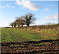
A field boundary hedge
Interspersed by trees. A winter crop can be seen growing in the field beside it. This view was taken from the public footpath which starts at Smee Lane > http://www.geograph.org.uk/photo/919906 and leads to the A47, further to the south > http://www.geograph.org.uk/photo/1068458 - http://www.geograph.org.uk/photo/1068463.
Image: © Evelyn Simak
Taken: 3 Dec 2008
0.07 miles
2
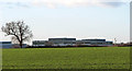
Cultivated field with winter crop
This field adjoins the path in the west. Buildings in Thorpe St Andrew's Business Park can be seen in the background (in adjacent grid square). This view was taken from the public footpath which starts at Smee Lane > http://www.geograph.org.uk/photo/919906 and leads to the A47, further to the south > http://www.geograph.org.uk/photo/1068458 - http://www.geograph.org.uk/photo/1068463.
Image: © Evelyn Simak
Taken: 3 Dec 2008
0.12 miles
4

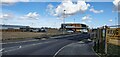
Field beside the path
This field adjoins the path in the west. The sugar beet crop is still in the process of being harvested. The view was taken from the public footpath which starts at Smee Lane > http://www.geograph.org.uk/photo/919906 and leads to the A47, further to the south > http://www.geograph.org.uk/photo/1068458 - http://www.geograph.org.uk/photo/1068463.
Image: © Evelyn Simak
Taken: 3 Dec 2008
0.13 miles
5

Harvest in progress
At the eastern-most end of this field the farmer was still busy harvesting his sugar beet crop. He will perhaps also pick up the little islands of green, such as the small area seen at left centre, which were missed. This view was taken from the public footpath which starts at Smee Lane > http://www.geograph.org.uk/photo/919906 and leads to the A47, further to the south > http://www.geograph.org.uk/photo/1068458 - http://www.geograph.org.uk/photo/1068463.
Image: © Evelyn Simak
Taken: 3 Dec 2008
0.13 miles
6
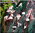
Mushrooms (Mycena spec) - seen beside the path
A forest of tiny mushrooms growing on a piece of decomposing tree trunk - some have already fallen victim to the recent cold temperatures.
These mushrooms belong to the Mycena species. Mushrooms of this species are rarely more than a few centimetres in width and characterized by a white spore print, a small conical or bell-shaped cap, and a thin fragile stem. Most are grey or brown, but a few species have brighter colours. Most have a translucent and striate cap, which rarely has an incurved margin. The gills are attached and usually have cystidia. A few of the species exude a latex when the stem is broken, and many have the odour of bleach. http://en.wikipedia.org/wiki/Mycena
Image: © Evelyn Simak
Taken: 3 Dec 2008
0.15 miles
7
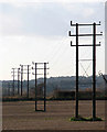
Electricity poles in stubble field
This view was taken from a public footpath which starts at Smee Lane > http://www.geograph.org.uk/photo/919906 and leads to the A47, further to the south > http://www.geograph.org.uk/photo/1068458 - http://www.geograph.org.uk/photo/1068463.
Image: © Evelyn Simak
Taken: 3 Dec 2008
0.16 miles
8

A muddy farm track
The path runs along the other side of the field boundary seen at left, starting at Smee Lane > http://www.geograph.org.uk/photo/919906. It leads to the A47, further to the south > http://www.geograph.org.uk/photo/1068458 - http://www.geograph.org.uk/photo/1068463.
Image: © Evelyn Simak
Taken: 3 Dec 2008
0.16 miles
9
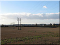
View across a stubble field
This view was taken from a public footpath which starts at Smee Lane > http://www.geograph.org.uk/photo/919906 and leads to the A47, further to the south > http://www.geograph.org.uk/photo/1068458 - http://www.geograph.org.uk/photo/1068463. The field seen in the foreground, traversed by an electricity line, adjoins the path in the west. Buildings located in the Business Park of Thorpe St Andrew can be seen in the background (at right, in adjacent grid square).
Image: © Evelyn Simak
Taken: 3 Dec 2008
0.17 miles
10

Sign advertising the Northern Distributor Road
The sign is located at a recently constructed roundabout at the start of the Northern Distributor Road, a short distance to the north-east of the Postwick Hub. For a wider view of this location see > http://www.geograph.org.uk/photo/4988179.
Image: © Evelyn Simak
Taken: 9 Jun 2016
0.19 miles