
IMAGES TAKEN NEAR TO
Yarmouth Road, NORWICH, NR13 5AS
Introduction
This page details the photographs taken nearby to Yarmouth Road, NR13 5AS by members of the Geograph project.
The Geograph project started in 2005 with the aim of publishing, organising and preserving representative images for every square kilometre of Great Britain, Ireland and the Isle of Man.

There are currently over 7.5m images from over14,400 individuals and you can help contribute to the project by visiting https://www.geograph.org.uk
Image Map
Images are licensed for reuse under creativecommons.org/licenses/by-sa/2.0
Notes
- Clicking on the map will re-center to the selected point.
- The higher the marker number, the further away the image location is from the centre of the postcode.
Image Listing (58 Images Found)
Images are licensed for reuse under creativecommons.org/licenses/by-sa/2.0
Image
Details
Distance
2
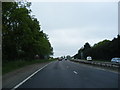
A47 Yarmouth Road, Brundall
Looking towards Norwich
Image: © Geographer
Taken: 1 Jun 2013
0.15 miles
3

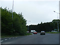
Sunday traffic
Cars rushing east on the busy A47. Viewed from the end of Hall Road, a cul-de-sac leading south from Witton Lane; it ends at the A47 > http://www.geograph.org.uk/photo/916627.
Image: © Evelyn Simak
Taken: 10 Aug 2008
0.16 miles
5
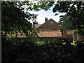
View from the churchyard
Witton Hall Farm, viewed from the churchyard of St Margaret's church > http://www.geograph.org.uk/photo/917112.
Image: © Evelyn Simak
Taken: 10 Aug 2008
0.19 miles
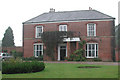
7
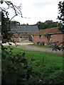
Red-brick farm barns
Barns belonging to Witton Hall Farm.
Image: © Evelyn Simak
Taken: 10 Aug 2008
0.20 miles
8
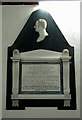
St Margaret's church - C19 memorial
To John Penrice (d 1844).
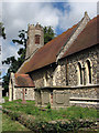
St Margaret's church > http://www.geograph.org.uk/photo/917112 - http://www.geograph.org.uk/photo/917130 - http://www.geograph.org.uk/photo/917152 is situated set back from the single-track Witton Lane, and because of its short tower it can easily be passed without noticing. A church was first documented here during the reign of Edward I (1272-1307). Since then the small church, built from flint and stone, has been altered several times, the most extensive restoration work having been carried out in the 19th century. Furnishings and stained glass windows > http://www.geograph.org.uk/photo/917140 - http://www.geograph.org.uk/photo/917144 - http://www.geograph.org.uk/photo/917158 date from this time; the octagonal baptismal font > http://www.geograph.org.uk/photo/917155 is C14; the rood screen was built in the first half of the 20th century. At some time (probably during the 17th century) the tower, the lower stage of which dates from the 15th century, was shortened and its top rebuilt in octagonal shape, topped by a brick parapet; the tower windows have fenestrated brickwork, a style also seen in local barns. There are a number of memorials (one seen here) - mainly C19 - the most noteworthy being a 15th century brass > http://www.geograph.org.uk/photo/917151 to Dame Juliana Anyell. The church is kept locked. See also: http://www.norfolkchurches.co.uk/witton/witton2.htm
Image: © Evelyn Simak
Taken: 10 Aug 2008
0.20 miles
10
St Margaret's Church - tomb chest
The side panels of this tomb chest have become loose; to prevent them from falling off they are being held in place by a steel band.
St Margaret's church > http://www.geograph.org.uk/photo/917112 - http://www.geograph.org.uk/photo/917130 - http://www.geograph.org.uk/photo/917152 is situated set back from the single-track Witton Lane, and because of its short tower it can easily be passed without noticing. A church was first documented here during the reign of Edward I (1272-1307). Since then the small church, built from flint and stone, has been altered several times, the most extensive restoration work having been carried out in the 19th century. Furnishings and stained glass windows > http://www.geograph.org.uk/photo/917140 - http://www.geograph.org.uk/photo/917144 - http://www.geograph.org.uk/photo/917158 date from this time; the octagonal baptismal font > http://www.geograph.org.uk/photo/917155 is C14; the rood screen was built in the first half of the 20th century. At some time (probably during the 17th century) the tower, the lower stage of which dates from the 15th century, was shortened and its top rebuilt in octagonal shape, topped by a brick parapet; the tower windows have fenestrated brickwork, a style also seen in local barns. There are a number of memorials > http://www.geograph.org.uk/photo/917146 - mainly C19 - the most noteworthy being a 15th century brass > http://www.geograph.org.uk/photo/917151 to Dame Juliana Anyell. The church is kept locked. See also: http://www.norfolkchurches.co.uk/witton/witton2.htm
Image: © Evelyn Simak
Taken: 10 Aug 2008
0.21 miles