
IMAGES TAKEN NEAR TO
Main Road, NORWICH, NR13 4TA
Introduction
This page details the photographs taken nearby to Main Road, NR13 4TA by members of the Geograph project.
The Geograph project started in 2005 with the aim of publishing, organising and preserving representative images for every square kilometre of Great Britain, Ireland and the Isle of Man.

There are currently over 7.5m images from over14,400 individuals and you can help contribute to the project by visiting https://www.geograph.org.uk
Image Map
Images are licensed for reuse under creativecommons.org/licenses/by-sa/2.0
Notes
- Clicking on the map will re-center to the selected point.
- The higher the marker number, the further away the image location is from the centre of the postcode.
Image Listing (61 Images Found)
Images are licensed for reuse under creativecommons.org/licenses/by-sa/2.0
Image
Details
Distance
1

Burlingham St Peter's ruined church
This tiny church has been neglected for many decades; it was once an attractive building with a lovely round tower. The collapse of the round tower in 1906, however, effectively brought about the final closure of the church 30 years later. The chancel arch is offset to the left of the nave but is central to the chancel, the nave being built a foot further to the south. It was probably done intentionally to create a place for the pulpit in a remarkably narrow church. It was refurbished by the Victorians, who removed most of its Norman origins. The font that once occupied the west of the nave was 14th century. Some of the fittings have been removed to St. Andrew’s church about 200 yards west of here. The mediaeval benches went to Blofield.
Image: © Adrian S Pye
Taken: 19 Apr 2009
0.02 miles
2

St Peter North Burlingham
The ruined church of St Peter North Burlingham, Norfolk for more info see http://www.norfolkchurches.co.uk/burlinghampeter/burlinghampeter.htm
Image: © Keith Evans
Taken: 23 Jul 2009
0.02 miles
3

The ruin of St Peter's church, North Burlingham
For more information see > http://www.geograph.org.uk/photo/2199554.
Image: © Evelyn Simak
Taken: 20 Jan 2011
0.02 miles
4
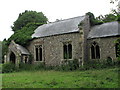
The ruin of St Peter's church, North Burlingham
For more information see > http://www.geograph.org.uk/photo/2199554.
Image: © Evelyn Simak
Taken: 13 Jul 2007
0.02 miles
5

The ruin of St Peter's church, North Burlingham
View east. For more information see > http://www.geograph.org.uk/photo/2199554. For a similar image taken three years later see > http://www.geograph.org.uk/photo/2239536.
Image: © Evelyn Simak
Taken: 13 Jul 2007
0.02 miles
6
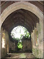
The ruin of St Peter's church, North Burlingham
View west. For more information see > http://www.geograph.org.uk/photo/2199554. For a similar image taken 3 years later see > http://www.geograph.org.uk/photo/2239538
Image: © Evelyn Simak
Taken: 13 Jul 2007
0.03 miles
7

The ruin of St Peter's church, North Burlingham - interior
For more information see > http://www.geograph.org.uk/photo/2199554.
Image: © Evelyn Simak
Taken: 20 Jan 2011
0.03 miles
8

The ruin of St Peter's church, North Burlingham
For more information see > http://www.geograph.org.uk/photo/2199554.
Image: © Evelyn Simak
Taken: 20 Jan 2011
0.04 miles
9

The ruin of St Peter's church, North Burlingham - interior
For more information see > http://www.geograph.org.uk/photo/2199554.
Image: © Evelyn Simak
Taken: 20 Jan 2011
0.04 miles
10

The ruin of St Peter's church, North Burlingham - churchyard
Old tomb chest in St Peter's > http://www.geograph.org.uk/photo/2239524 churchyard.
Image: © Evelyn Simak
Taken: 20 Jan 2011
0.04 miles