IMAGES TAKEN NEAR TO
High House Lane, NORWICH, NR13 4PR
Introduction
This page details the photographs taken nearby to High House Lane, NR13 4PR by members of the Geograph project.
The Geograph project started in 2005 with the aim of publishing, organising and preserving representative images for every square kilometre of Great Britain, Ireland and the Isle of Man.

There are currently over 7.5m images from over14,400 individuals and you can help contribute to the project by visiting https://www.geograph.org.uk
Image Map
Images are licensed for reuse under creativecommons.org/licenses/by-sa/2.0
Notes
- Clicking on the map will re-center to the selected point.
- The higher the marker number, the further away the image location is from the centre of the postcode.
Image Listing (11 Images Found)
Images are licensed for reuse under creativecommons.org/licenses/by-sa/2.0
Image
Details
Distance
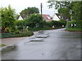
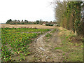
3
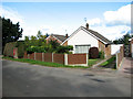
Bungalows in Pedham Road, Hemblington Corner
Image: © Evelyn Simak
Taken: 19 Oct 2010
0.12 miles
4
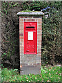
George V postbox in Pedham Road, Hemblington Corner
For a wider view of this location see > http://www.geograph.org.uk/photo/2119269.
Image: © Evelyn Simak
Taken: 19 Oct 2010
0.12 miles
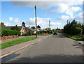
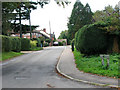
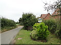
6
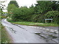
Cuttons Corner, Hemblington Hall Road
Image: © Ian Robertson
Taken: 16 May 2007
0.18 miles
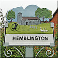
7
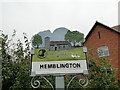
Hemblington village sign
The sign was unveiled on the 25th September 2021. The new sign depicts the Anglo-Saxon All Saints Church and a boot, representing shoemaker Jeremiah Cutton after whom Cutton's Corner, (adjacent to the sign's location) is named.
As well as the church, the sign illustrates the agricultural nature of the village by a tractor under the trees which themselves represent the various woodlands of the area, with geese in the foreground.
Image: © Adrian S Pye
Taken: 3 Oct 2021
0.18 miles
8
Hemblington village sign on Hemblington Hall Road
The sign was unveiled on the 25th September 2021. The new sign depicts the Anglo-Saxon All Saints Church and a boot, representing shoemaker Jeremiah Cutton after whom Cutton's Corner, (adjacent to the sign's location) is named.
As well as the church, the sign illustrates the agricultural nature of the village by a tractor under the trees which themselves represent the various woodlands of the area, with geese in the foreground. https://www.geograph.org.uk/photo/6980330
Image: © Adrian S Pye
Taken: 3 Oct 2021
0.18 miles
9
Hemblington village sign
The sign was unveiled on the 25th September 2021. The new sign depicts the Anglo-Saxon All Saints Church and a boot, representing shoemaker Jeremiah Cutton after whom Cutton's Corner, (adjacent to the sign's location) is named.
As well as the church, the sign illustrates the agricultural nature of the village by a tractor under the trees which themselves represent the various woodlands of the area, with geese in the foreground.
Image: © Adrian S Pye
Taken: 3 Oct 2021
0.19 miles