IMAGES TAKEN NEAR TO
Yarmouth Road, NORWICH, NR13 4DS
Introduction
This page details the photographs taken nearby to Yarmouth Road, NR13 4DS by members of the Geograph project.
The Geograph project started in 2005 with the aim of publishing, organising and preserving representative images for every square kilometre of Great Britain, Ireland and the Isle of Man.

There are currently over 7.5m images from over14,400 individuals and you can help contribute to the project by visiting https://www.geograph.org.uk
Image Map
Images are licensed for reuse under creativecommons.org/licenses/by-sa/2.0
Notes
- Clicking on the map will re-center to the selected point.
- The higher the marker number, the further away the image location is from the centre of the postcode.
Image Listing (18 Images Found)
Images are licensed for reuse under creativecommons.org/licenses/by-sa/2.0
Image
Details
Distance
1
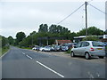
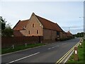
Yarmouth Road & Blofield Motor Company
http://www.blofieldmotorcompany.co.uk/
Image: © Geographer
Taken: 1 Jun 2013
0.03 miles
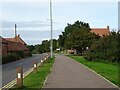
3
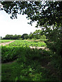
Shack Lane
This section of Shack Lane runs parallel with the A47, separated by a narrow strip of woodland and there is a constant noise of passing traffic.
Image: © Evelyn Simak
Taken: 10 Aug 2008
0.13 miles
5
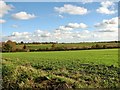
Crop fields between Brundall and Blofield
The tower seen in the distance is that of the church of SS Andrew and Peter in Blofield.
Image: © Evelyn Simak
Taken: 11 Nov 2018
0.16 miles
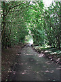
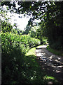
6
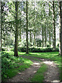
Track into woodland
Which appears to be very well maintained.
Image: © Evelyn Simak
Taken: 10 Aug 2008
0.16 miles
7
Potato crop
Growing beside Shack Lane.
Image: © Evelyn Simak
Taken: 10 Aug 2008
0.16 miles
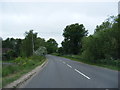
9
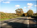
This way to Blofield
On Yarmouth Road.
Image: © Evelyn Simak
Taken: 11 Nov 2018
0.17 miles
10
Skirting Dawling's Wood
Here Shack Lane skirts the southeastern edge of Dawling's Wood before taking another sharp bend and leading parallel to the A47 in northeasterly direction.
Image: © Evelyn Simak
Taken: 10 Aug 2008
0.17 miles