IMAGES TAKEN NEAR TO
Homelea Crescent, NORWICH, NR13 4BP
Introduction
This page details the photographs taken nearby to Homelea Crescent, NR13 4BP by members of the Geograph project.
The Geograph project started in 2005 with the aim of publishing, organising and preserving representative images for every square kilometre of Great Britain, Ireland and the Isle of Man.

There are currently over 7.5m images from over14,400 individuals and you can help contribute to the project by visiting https://www.geograph.org.uk
Image Map
Images are licensed for reuse under creativecommons.org/licenses/by-sa/2.0
Notes
- Clicking on the map will re-center to the selected point.
- The higher the marker number, the further away the image location is from the centre of the postcode.
Image Listing (61 Images Found)
Images are licensed for reuse under creativecommons.org/licenses/by-sa/2.0
Image
Details
Distance
2
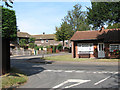
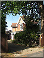
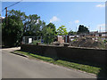
Junction of Buckenham Road with Norwich Road
Image: © Evelyn Simak
Taken: 20 Sep 2009
0.10 miles


9

Lingwood Railway Station
View west along the railway line in the up (Norwich-bound) direction. Lingwood station > http://www.geograph.org.uk/photo/1497738 dates back to 1882 > http://www.geograph.org.uk/photo/1497729. Originally built by the Great Eastern Railway Company, there used to be a grain store adjoining the station which at that time had sidings and a second platform. The building was closed as a railway station in 1965 after which time it used to house dress shop and later a doctor's surgery, before it was left derelict for several years in the early eighties when the current owners bought it from British Rail in 1989. After renovation - but retaining many of the original features - Station Cottage > http://www.geograph.org.uk/photo/1497728 was opened as a bed & breakfast establishment in 1990. The old signal box has been replaced by a modern building > http://www.geograph.org.uk/photo/1497701 but the two nearby level crossings - one on Station Road and the other on Chapel Road - still have the original manually-operated crossing gates adjoined by the crossing house > http://www.geograph.org.uk/photo/1497697. The station is served by National Express East Anglia, train services to Norwich and to Great Yarmouth are hourly on weekdays and two-hourly in each direction on Sundays.
Image: © Evelyn Simak
Taken: 20 Sep 2009
0.13 miles