
IMAGES TAKEN NEAR TO
Mill Road, NORWICH, NR13 3TT
Introduction
This page details the photographs taken nearby to Mill Road, NR13 3TT by members of the Geograph project.
The Geograph project started in 2005 with the aim of publishing, organising and preserving representative images for every square kilometre of Great Britain, Ireland and the Isle of Man.

There are currently over 7.5m images from over14,400 individuals and you can help contribute to the project by visiting https://www.geograph.org.uk
Image Map
Images are licensed for reuse under creativecommons.org/licenses/by-sa/2.0
Notes
- Clicking on the map will re-center to the selected point.
- The higher the marker number, the further away the image location is from the centre of the postcode.
Image Listing (87 Images Found)
Images are licensed for reuse under creativecommons.org/licenses/by-sa/2.0
Image
Details
Distance
1

Reedham village sign
In the centre of the sign is Margaret Paston who was born in the parish and was a benefactor to the church of St John seen in the background. On her left is a Viking longboat passing St Benet’s Abbey and on the right a Norfolk Wherry with Polkey's Mill in the background. On the spandrels is the Hatton family Crest; a grey heron and a spoonbill often seen on the marshes. The opposite spandrel has bricks, a reminder of the brickworks and feathers representing Pettitt’s feather factory and the family crest of the Berney family. http://www.geograph.org.uk/photo/4438500
Image: © Adrian S Pye
Taken: 20 Apr 2015
0.02 miles
2

Reedham village sign (detail)
In the centre of the sign is Margaret Paston who was born in the parish and was a benefactor to the church of St John seen in the background. On her left is a Viking longboat passing St Benet’s Abbey and on the right a Norfolk Wherry with Polkey's Mill in the background. On the spandrels is the Hatton family Crest; a grey heron and a spoonbill often seen on the marshes. The opposite spandrel has bricks, a reminder of the brickworks and feathers representing Pettitt’s feather factory and the family crest of the Berney family. http://www.geograph.org.uk/photo/4438499
Image: © Adrian S Pye
Taken: 20 Apr 2015
0.02 miles
3

Reedham Village Sign
Placed at the junction of Mill Road and Church View Road, in 1983
Image: © Eirian Evans
Taken: 9 Jul 2019
0.02 miles
4
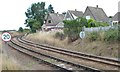
The railway line to Lowestoft
Curving round the west side of the former Reedham triangle.
Image: © Christine Johnstone
Taken: 31 Aug 2013
0.07 miles
5

Houses on Church View Close
Hugging the curve of the railway line to Lowestoft.
Image: © Christine Johnstone
Taken: 31 Aug 2013
0.07 miles
6

Reedham Junction
The first route to Great Yarmouth, built in the 1840s by Grissel and Peto. Only a few years later the doubled trackbed branch to Lowestoft opened on the right.
Image: © Ashley Dace
Taken: 22 Jun 2010
0.08 miles
7

The Wherry Line at Reedham
Managed by Greater Anglia.
Image: © Eirian Evans
Taken: 9 Jul 2019
0.08 miles
8

Semaphore signal
The signal has a white 'Sight board' to increase visibility of the signal arm against the dark background of the road bridge, part of which is just visible on the left of the photo.
Image: © Ashley Dace
Taken: 23 Jul 2009
0.09 miles
9

Farmland north of Reedham
Taken from the railway. The distant houses are in Church Road.
Image: © Christine Johnstone
Taken: 31 Aug 2013
0.10 miles
10

Reedham station photo-survey (17)
Looking in the down (eastbound) direction from the bridge carrying Witton Green over the railway 300 metres east of Reedham station. The track on the left of this photo is the single track route northeast to Yarmouth. The two lines diverging to the right are the double track route southeast to Lowestoft.
Reedham station is behind the photographer (see [http://www.geograph.org.uk/photo/1480861] for a view from this location). The station is on the ex-Great Eastern Rly route from Norwich to Lowestoft and has two platforms, one for up (Norwich-bound) traffic and one for down (Yarmouth and Lowestoft) traffic. The majority of passenger services are operated by National Express.
Image: © Andy F
Taken: 6 Sep 2009
0.11 miles