
IMAGES TAKEN NEAR TO
Norwich Road, NORWICH, NR13 3BU
Introduction
This page details the photographs taken nearby to Norwich Road, NR13 3BU by members of the Geograph project.
The Geograph project started in 2005 with the aim of publishing, organising and preserving representative images for every square kilometre of Great Britain, Ireland and the Isle of Man.

There are currently over 7.5m images from over14,400 individuals and you can help contribute to the project by visiting https://www.geograph.org.uk
Image Map
Images are licensed for reuse under creativecommons.org/licenses/by-sa/2.0
Notes
- Clicking on the map will re-center to the selected point.
- The higher the marker number, the further away the image location is from the centre of the postcode.
Image Listing (189 Images Found)
Images are licensed for reuse under creativecommons.org/licenses/by-sa/2.0
Image
Details
Distance
3
Country & Equestrian store in Norwich Road
Image: © Evelyn Simak
Taken: 7 Sep 2009
0.07 miles
4

A47 in shade and sunshine
I suppose the sun can't shine on both side of the hedge.
Image: © Adrian S Pye
Taken: 5 Jan 2011
0.12 miles

6

East Anglian Air Ambulance helicopter
The pilot was clearly looking for something, flying low above Norwich Road and then back in a circle over the church's roof > http://www.geograph.org.uk/photo/5189401 while a number of marked and unmarked police cars with sirens blaring and lights flashing could be seen speeding down the two major roads, The Street and Norwich Road, and heading in northerly direction from there.
Image: © Evelyn Simak
Taken: 5 Oct 2016
0.13 miles
7

East Anglian Air Ambulance helicopter
The pilot was clearly looking for something, flying low above Norwich Road and then back in a circle over the church's roof > http://www.geograph.org.uk/photo/5189401 while a number of marked and unmarked police cars with sirens blaring and lights flashing could be seen speeding down the two major roads, The Street and Norwich Road, and heading in northerly direction from there.
Image: © Evelyn Simak
Taken: 5 Oct 2016
0.13 miles
8

East Anglian Air Ambulance helicopter
The pilot was clearly looking for something, flying low above Norwich Road and then back in a circle over the church's roof > http://www.geograph.org.uk/photo/5189401 while a number of marked and unmarked police cars with sirens blaring and lights flashing could be seen speeding down the two major roads, The Street and Norwich Road, and heading in northerly direction from there.
Image: © Evelyn Simak
Taken: 5 Oct 2016
0.14 miles
9
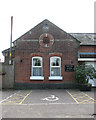
Acle railway station - the station building
This view was taken from Station Road. The date stone > http://www.geograph.org.uk/photo/1477316 gives the year of its construction as 1881. The letters GER stand for Great Eastern Railway.
Acle railway station > http://www.geograph.org.uk/photo/1477327 was built in 1881 as the datestones on station building and station house indicate. The station was opened by the GER (Great Eastern Railway) and in 1923 became part of the London and North Eastern Railway. On nationalisation in 1948 it passed on to the Eastern Region of British Railways and was later served by regional railways until the privatisation of British railways. Presently Acle is served by National Express East Anglia who operate services between Norwich and Great Yarmouth using diesel multiple units of classes 153, 156 > http://www.geograph.org.uk/photo/1477378 or 170. The station is unmanned. The station house > http://www.geograph.org.uk/photo/1477340 has been converted into a private dwelling and the station building serves as a self-catering holiday cottage. Acle is the only station on this branch of the Wherry Line which has a passing loop > http://www.geograph.org.uk/photo/1477397. At some time in the past it was a coaling depot which was located just west of the former goods shed > http://www.geograph.org.uk/photo/1477402 which still stands.
Image: © Evelyn Simak
Taken: 7 Sep 2009
0.14 miles
10
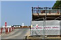
Acle: Entrance to a new housing development
Image: © Michael Garlick
Taken: 20 Jul 2021
0.14 miles