IMAGES TAKEN NEAR TO
Christopher Close, NORWICH, NR1 2PQ
Introduction
This page details the photographs taken nearby to Christopher Close, NR1 2PQ by members of the Geograph project.
The Geograph project started in 2005 with the aim of publishing, organising and preserving representative images for every square kilometre of Great Britain, Ireland and the Isle of Man.

There are currently over 7.5m images from over14,400 individuals and you can help contribute to the project by visiting https://www.geograph.org.uk
Image Map (Loading...)


Getting Data...Please wait
Leaflet Map data © OpenStreetMap
Images are licensed for reuse under creativecommons.org/licenses/by-sa/2.0
Notes
- Clicking on the map will re-center to the selected point.
- The higher the marker number, the further away the image location is from the centre of the postcode.
Image Listing (169 Images Found)
Images are licensed for reuse under creativecommons.org/licenses/by-sa/2.0
Image
Details
Distance

2
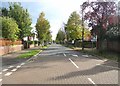
View east along Cecil Road
Cecil Road is named after Cecil Edward Trafford, one of the twelve children of Edward Southwell Trafford and his wife the Honourable Eleanor Mary Petre.
Image: © Evelyn Simak
Taken: 30 Oct 2019
0.09 miles


5

Shops in St John's Close
The premises depicted here house a Kodak Express, Rish n Chips shop > https://www.geograph.org.uk/photo/6238723 , off-licence grocers and newsagents.
According to the current owner of 'Rish n Chips', this has always been a fish and chips shop, opened about 50 years ago. About 17 years ago it was owned by an Indian family with the proprietor's name having been Rish. Despite having had several owners since, the shop has been known as 'Rish n Chips' ever since.
Image: © Evelyn Simak
Taken: 15 Aug 2019
0.09 miles

7

St John's Close, Hall Road, Norwich
A cul-de-sac of local shops, built between the two world wars (post box is from George V's reign). To the right of the close, the Railway Path (formerly railway line leading to Norwich Victoria Railway Station) passes in a cutting.
Image: © Paul Shreeve
Taken: 4 Feb 2008
0.09 miles

9

Pavement passing shop fronts in St John's Close
Note the Rish n Chips shop. The sign on the wall also advertising this shop clarifies by calling it what it is - a Fish & Chips shop. See also > https://www.geograph.org.uk/photo/6238727.
Image: © Evelyn Simak
Taken: 15 Aug 2019
0.09 miles
