
IMAGES TAKEN NEAR TO
Martineau Lane, NORWICH, NR1 2DW
Introduction
This page details the photographs taken nearby to Martineau Lane, NR1 2DW by members of the Geograph project.
The Geograph project started in 2005 with the aim of publishing, organising and preserving representative images for every square kilometre of Great Britain, Ireland and the Isle of Man.

There are currently over 7.5m images from over14,400 individuals and you can help contribute to the project by visiting https://www.geograph.org.uk
Image Map
Images are licensed for reuse under creativecommons.org/licenses/by-sa/2.0
Notes
- Clicking on the map will re-center to the selected point.
- The higher the marker number, the further away the image location is from the centre of the postcode.
Image Listing (224 Images Found)
Images are licensed for reuse under creativecommons.org/licenses/by-sa/2.0
Image
Details
Distance
1
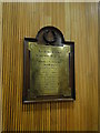
WW1 Memorial to Norfolk teachers
The memorial which is housed in County Hall, Norwich bears the names of 15 teachers who fought and fell in The Great War
Image: © Adrian S Pye
Taken: 14 Feb 2018
0.00 miles
2

County Hall, Norwich
This building was by architect Reginald H. Uren and opened by the Queen in 1968. It has traditional faience slabs on most elevations.
Image: © Richard Rogerson
Taken: 11 Sep 2012
0.01 miles
3

County Hall
County Hall for Norfolk County council Norwich Norfolk. For other view see http://www.geograph.org.uk/photo/886023
Image: © Keith Evans
Taken: 16 Jul 2008
0.02 miles
4

Norfolk County Hall, Martineau Lane
At the extreme south-west corner of the grid-square stands Norfolk County Hall which was opened on 24th May 1968 by H.M. Queen Elizabeth II. The land on which it was built was once part of the estate of Dr Philip Meadows Martineau (1752-1829), an eminent surgeon who practised for over 50 years at the Norfolk and Norwich Hospital and after whom Martineau Lane was named. http://www.eveningnews24.co.uk/content/Features/DerekJames/StreetNames/extra/040818Martineau.aspx
Image: © Graham Hardy
Taken: 17 Apr 2006
0.02 miles

6

Norwich County Hall
As seen from Bixley.
Image: © Evelyn Simak
Taken: 8 Mar 2015
0.03 miles
7

View towards County Hall
Across crop fields at Bixley.
Image: © Evelyn Simak
Taken: 8 Mar 2015
0.03 miles
8

County Hall, Martineau Lane, Norwich
By Slater & Uren, 1966. A large complex sitting in quite extensive grounds (presumably belonging to the house which previously stood on the site). The building is steel-framed but clad largely in brick, a concession to traditionalists perhaps?
Still home to Norfolk County Council.
Image: © Stephen Richards
Taken: 17 Jun 2013
0.03 miles
9

Norwich County Hall
As seen from the west. The building is currently clad in scaffolding. The aircraft seen in the foreground is a Jaguar GR1 XW563 which once used to guard the main entrance to RAF Coltishall > http://www.geograph.org.uk/photo/291466. When the airfield was sold in 2007 it was re-located to Norwich County Hall where it can be found beside the Archive Centre. It serves as a permanent memorial to all the Jaguar Force members who lost their lives during the course of their duties > http://www.geograph.org.uk/photo/4166176.
Image: © Evelyn Simak
Taken: 15 Sep 2014
0.03 miles
10

Norwich County Hall
As seen from the west. The building is currently clad in scaffolding. The aircraft seen in the foreground is a Jaguar GR1 XW563 which once used to guard the main entrance to RAF Coltishall > http://www.geograph.org.uk/photo/291466. When the airfield was sold in 2007 it was re-located to Norwich County Hall where it can be found beside the Archive Centre. It serves as a permanent memorial to all the Jaguar Force members who lost their lives during the course of their duties > http://www.geograph.org.uk/photo/4166176.
Image: © Evelyn Simak
Taken: 15 Sep 2014
0.03 miles