IMAGES TAKEN NEAR TO
Wayford Road, NORWICH, NR12 9LQ
Introduction
This page details the photographs taken nearby to Wayford Road, NR12 9LQ by members of the Geograph project.
The Geograph project started in 2005 with the aim of publishing, organising and preserving representative images for every square kilometre of Great Britain, Ireland and the Isle of Man.

There are currently over 7.5m images from over14,400 individuals and you can help contribute to the project by visiting https://www.geograph.org.uk
Image Map
Images are licensed for reuse under creativecommons.org/licenses/by-sa/2.0
Notes
- Clicking on the map will re-center to the selected point.
- The higher the marker number, the further away the image location is from the centre of the postcode.
Image Listing (23 Images Found)
Images are licensed for reuse under creativecommons.org/licenses/by-sa/2.0
Image
Details
Distance
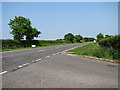
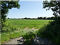
3
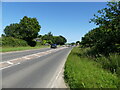
Looking towards junction of B1159 and A149
Image: © David Pashley
Taken: 16 Jul 2021
0.12 miles
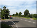
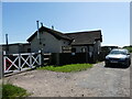
5
NE past house on Stepping Stone Lane (B1159)
Image: © Evelyn Simak
Taken: 23 Sep 2007
0.15 miles
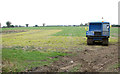
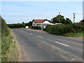
8
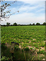
View west across sugar beet and wellie boot
Image: © Evelyn Simak
Taken: 23 Sep 2007
0.16 miles