
IMAGES TAKEN NEAR TO
Neatishead Road, NORWICH, NR12 8LB
Introduction
This page details the photographs taken nearby to Neatishead Road, NR12 8LB by members of the Geograph project.
The Geograph project started in 2005 with the aim of publishing, organising and preserving representative images for every square kilometre of Great Britain, Ireland and the Isle of Man.

There are currently over 7.5m images from over14,400 individuals and you can help contribute to the project by visiting https://www.geograph.org.uk
Image Map
Images are licensed for reuse under creativecommons.org/licenses/by-sa/2.0
Notes
- Clicking on the map will re-center to the selected point.
- The higher the marker number, the further away the image location is from the centre of the postcode.
Image Listing (68 Images Found)
Images are licensed for reuse under creativecommons.org/licenses/by-sa/2.0
Image
Details
Distance
4
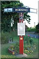
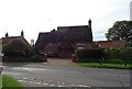
Village sign
The village sign at Horning, Norfolk
Image: © Craig Tuck
Taken: 1 Jul 2009
0.07 miles
6
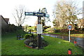
Horning village sign
Another sign which would benefit from some detergent. It depicts, on the wings, the church, a sailing yacht and a windpump. On the post is understood to be the crest of the bishop of St Benet’s abbey at Hulme or Holm. https://www.geograph.org.uk/photo/6704917
Image: © Adrian S Pye
Taken: 14 Dec 2020
0.08 miles
7
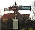
Horning village sign
Another sign which would benefit from some detergent. It depicts, on the wings, the church, a sailing yacht and a windpump. On the post is understood to be the crest of the bishop of St Benet’s abbey at Hulme or Holm. https://www.geograph.org.uk/photo/6704918
Image: © Adrian S Pye
Taken: 14 Dec 2020
0.08 miles
10
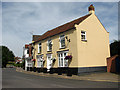
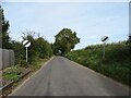
View along Lower Street
As it heads out of the village in northwesterly direction.
The village of Horning is situated on the northern bank of the River Bure, stretching for about a mile. Lower Street, its main thoroughfare, runs parallel to the river; it is lined with shops, restaurants, B&B establishments and attractive houses and cottages. The history of Horning dates back to 1020 when the manor was given by King Canute to the newly founded Abbey of St Benet.
Image: © Evelyn Simak
Taken: 30 Jul 2008
0.18 miles