IMAGES TAKEN NEAR TO
Letheringtons Lane, NORWICH, NR12 8JT
Introduction
This page details the photographs taken nearby to Letheringtons Lane, NR12 8JT by members of the Geograph project.
The Geograph project started in 2005 with the aim of publishing, organising and preserving representative images for every square kilometre of Great Britain, Ireland and the Isle of Man.

There are currently over 7.5m images from over14,400 individuals and you can help contribute to the project by visiting https://www.geograph.org.uk
Image Map
Images are licensed for reuse under creativecommons.org/licenses/by-sa/2.0
Notes
- Clicking on the map will re-center to the selected point.
- The higher the marker number, the further away the image location is from the centre of the postcode.
Image Listing (54 Images Found)
Images are licensed for reuse under creativecommons.org/licenses/by-sa/2.0
Image
Details
Distance
1
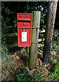
George VI postbox on Ropes Hill, Horning
Postbox No. NR12 1258.
See Image] for context.
Image: © JThomas
Taken: 5 Oct 2023
0.02 miles
2
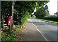
Ropes Hill (A1062), Horning
Showing position of Postbox No. NR12 1258.
See Image] for context.
Image: © JThomas
Taken: 5 Oct 2023
0.02 miles
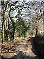
5

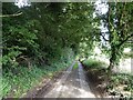
Private track to house beside Long Lane
Image: © Evelyn Simak
Taken: 16 Feb 2008
0.12 miles
6
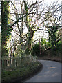
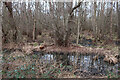
Sharp bend in Long Lane
The fence seen at left surrounds Burntfen Broad.
Image: © Evelyn Simak
Taken: 16 Feb 2008
0.13 miles
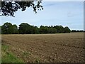
7
Heading east on Long Lane past Burnt Fen
Image: © Evelyn Simak
Taken: 16 Feb 2008
0.14 miles
8
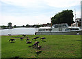
Geese grazing
Greylag geese and their almost fully grown offspring are keeping the grass short here by the staithe; the bird seen in the foreground is keeping an eye on, and occasionally hissing at, the photographer. The view is upstream along the River Bure.
Image: © Evelyn Simak
Taken: 30 Jul 2008
0.14 miles
9
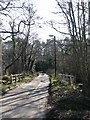
View south along Long Lane
Long Covert can be seen at right (west), Burntfen Broad is on the other side of the road; the bridge spans a drain.
Image: © Evelyn Simak
Taken: 16 Feb 2008
0.15 miles