
IMAGES TAKEN NEAR TO
Sco Ruston Road, NORWICH, NR12 8ET
Introduction
This page details the photographs taken nearby to Sco Ruston Road, NR12 8ET by members of the Geograph project.
The Geograph project started in 2005 with the aim of publishing, organising and preserving representative images for every square kilometre of Great Britain, Ireland and the Isle of Man.

There are currently over 7.5m images from over14,400 individuals and you can help contribute to the project by visiting https://www.geograph.org.uk
Image Map
Images are licensed for reuse under creativecommons.org/licenses/by-sa/2.0
Notes
- Clicking on the map will re-center to the selected point.
- The higher the marker number, the further away the image location is from the centre of the postcode.
Image Listing (7 Images Found)
Images are licensed for reuse under creativecommons.org/licenses/by-sa/2.0
Image
Details
Distance
1

Long Plantation
The low light is enhancing the autumnal colours of trees that grow on the edge of Long Plantation.
Image: © Evelyn Simak
Taken: 19 Nov 2007
0.13 miles
2

New crop growing
... in a field. The solitary trees at left mark the course of Tunstead road that connects the B1150 with the village of Tunstead.
Image: © Evelyn Simak
Taken: 19 Nov 2007
0.15 miles

4

Mid-November sunshine
This view was taken when the sun put in a short appearance on this otherwise dull and bleak mid-November day, with the low light briefly enhancing the colours of this hedge alongside Tunstead Road.
Image: © Evelyn Simak
Taken: 19 Nov 2007
0.16 miles
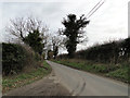
6

Looking south
... against the sun, through a curtain of bare hedge.
Image: © Evelyn Simak
Taken: 19 Nov 2007
0.21 miles
7

Looking west on Tunstead Road
Tunstead Road is a quiet single-track country lane that connects the B1150 with Tunstead.
Image: © Evelyn Simak
Taken: 19 Nov 2007
0.22 miles