
IMAGES TAKEN NEAR TO
Pound Hill, NORWICH, NR12 7AD
Introduction
This page details the photographs taken nearby to Pound Hill, NR12 7AD by members of the Geograph project.
The Geograph project started in 2005 with the aim of publishing, organising and preserving representative images for every square kilometre of Great Britain, Ireland and the Isle of Man.

There are currently over 7.5m images from over14,400 individuals and you can help contribute to the project by visiting https://www.geograph.org.uk
Image Map
Images are licensed for reuse under creativecommons.org/licenses/by-sa/2.0
Notes
- Clicking on the map will re-center to the selected point.
- The higher the marker number, the further away the image location is from the centre of the postcode.
Image Listing (25 Images Found)
Images are licensed for reuse under creativecommons.org/licenses/by-sa/2.0
Image
Details
Distance
1
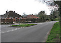
View southwest along Mill Road
The junction seen at left is with Post Office Road.
Image: © Evelyn Simak
Taken: 9 Apr 2008
0.01 miles
2
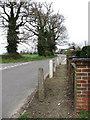
A very short section of pavement
Where Buxton Road becomes Mill Road. The junction at left is with Court Hill. The (disused) towermill > Image can just be seen through the trees, at left.
Image: © Evelyn Simak
Taken: 9 Apr 2008
0.01 miles
3
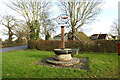
Frettenham village sign
The Viking longship on the sign is a reference to the origins of the village. The five-storey mill (in red) was built in 1880 and has been converted into a private residence among a number of new houses. The ploughshare is a link to the agricultural heritage of the parish. A steel-bound millstone sits on top of the circular base of the sign.
https://www.geograph.org.uk/photo/6705291
Image: © Adrian S Pye
Taken: 14 Dec 2020
0.05 miles
4
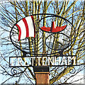
Frettenham village sign
The Viking longship on the sign is a reference to the origins of the village. The five-storey mill (in red) was built in 1880 and has been converted into a private residence among a number of new houses. The ploughshare is a link to the agricultural heritage of the parish. A steel-bound millstone sits on top of the circular base of the sign.
https://www.geograph.org.uk/photo/6705293
Image: © Adrian S Pye
Taken: 14 Dec 2020
0.05 miles
5
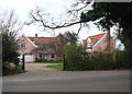
Pink House
In the triangle between Buxton Road and Court Hill > Image
Image: © Evelyn Simak
Taken: 9 Apr 2008
0.05 miles
6
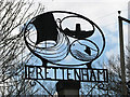
Village sign
The village sign is located on a small green, in the triangle formed by Post Office Road and Hall Road. See also > Image
Image: © Evelyn Simak
Taken: 9 Apr 2008
0.06 miles
7
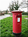
Pillar box on village green
The small triangular-shaped green is located between Post Office Road and Mill Road. The view is southwesterly, towards the junction with Mill Road and Court Hill beyond.
Image: © Evelyn Simak
Taken: 9 Apr 2008
0.06 miles
8
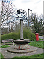
Village green
The green, accommodating a wooden seat, a pillar box and the village sign, is located in the triangle formed between Post Office Road and Mill Road; the view is towards Post Office Road.
Image: © Evelyn Simak
Taken: 9 Apr 2008
0.07 miles
9

Bags of horse manure
Can be acquired here for 50p each; alongside the sign affixed to the tree, there is also a little blue box where payments can be deposited.
Image: © Evelyn Simak
Taken: 9 Apr 2008
0.08 miles
