IMAGES TAKEN NEAR TO
Lynton Road, NORWICH, NR12 0NA
Introduction
This page details the photographs taken nearby to Lynton Road, NR12 0NA by members of the Geograph project.
The Geograph project started in 2005 with the aim of publishing, organising and preserving representative images for every square kilometre of Great Britain, Ireland and the Isle of Man.

There are currently over 7.5m images from over14,400 individuals and you can help contribute to the project by visiting https://www.geograph.org.uk
Image Map
Images are licensed for reuse under creativecommons.org/licenses/by-sa/2.0
Notes
- Clicking on the map will re-center to the selected point.
- The higher the marker number, the further away the image location is from the centre of the postcode.
Image Listing (154 Images Found)
Images are licensed for reuse under creativecommons.org/licenses/by-sa/2.0
Image
Details
Distance
1
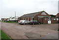
Walcott village hall
Where The Crescent (seen in the foreground) turns off the Coast Road.
Image: © Evelyn Simak
Taken: 6 Nov 2008
0.02 miles

3

Approaching Walcott
Approach to Walcott from the south, on Coast Road. The junction seen in mid-distance (at right) is with Ostend Road. For a view taken across Coast Road from the junction see > http://www.geograph.org.uk/photo/1035907.
Image: © Evelyn Simak
Taken: 6 Nov 2008
0.04 miles
4

Storm surge damage, Walcott
Clean-up in progress by the village hall in Walcott. On 5 December 2013, a storm surge, said to have been the worst in 60 years, flooded the coastal village of Walcott. Five days later, the main road through the village is still closed > http://www.geograph.org.uk/photo/3774028 and workers are busy removing lots of sand which had been washed onto it. A number of sea front chalets were destroyed or badly damaged by flood water, and gardens and side roads are still covered with debris. People from 13 homes have been moved into emergency accommodation. The public footpath leading along the top of the sea wall is also still closed > http://www.geograph.org.uk/photo/3774043.
Image: © Evelyn Simak
Taken: 10 Dec 2013
0.04 miles