1
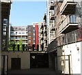
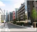
New development on Geoffrey Watling Way
The new development overlooks the football stadium on the right. The road is named after a former chairman of Norwich City Football Club.
Image: © Bill Boaden
Taken: 30 Dec 2013
0.00 miles
2
New blocks of flats on Geoffrey Watling Way
Image: © Evelyn Simak
Taken: 18 May 2018
0.00 miles
3
Geoffrey Watling Way past the Carrow Road football stadium
The stadium > http://www.geograph.org.uk/photo/5779789 was constructed in just 82 days during the summer of 1935 and opened on 31 August 1935 with a league match between Norwich and West Ham. Initially the stadium comprised on covered seating stand and open terraces on earth banking on the other three sides and the ground could hold about 38,000 spectators. The highest attendance was recorded in 1963, when 43,984 people saw an FA Cup match between Norwich and Leicester City. Although two of the four stands were rebuilt in the elary 1980s, the overall capacity of the stadium was reduced to hold about 28,000, due to safety measures. Ten years later, the stadium was converted into an all-seater, involving the custruction of a new stand called The Barclay, and in 2003, the South Stand was replaced by a new stand called the Jarrold Stand, which was further extended in 2005 by linking it to the Peterborough Stand. The Carrow Road Stadium is the home of the Norwich City FC, also known as the Canaries.
Image: © Evelyn Simak
Taken: 18 May 2018
0.01 miles
4
Carrow Road football stadium - the Aviva Community Stand
The stadium > http://www.geograph.org.uk/photo/5779789 was constructed in just 82 days during the summer of 1935 and opened on 31 August 1935 with a league match between Norwich and West Ham. Initially the stadium comprised on covered seating stand and open terraces on earth banking on the other three sides and the ground could hold about 38,000 spectators. The highest attendance was recorded in 1963, when 43,984 people saw an FA Cup match between Norwich and Leicester City. Although two of the four stands were rebuilt in the elary 1980s, the overall capacity of the stadium was reduced to hold about 28,000, due to safety measures. Ten years later, the stadium was converted into an all-seater, involving the custruction of a new stand called The Barclay, and in 2003, the South Stand was replaced by a new stand called the Jarrold Stand, which was further extended in 2005 by linking it to the Peterborough Stand. The Carrow Road Stadium is the home of the Norwich City FC, also known as the Canaries.
Image: © Evelyn Simak
Taken: 18 May 2018
0.02 miles
5
Carrow Road football stadium - the Aviva Community Stand
For a wider view of this location see > http://www.geograph.org.uk/photo/5779777 and http://www.geograph.org.uk/photo/5779789.
Image: © Evelyn Simak
Taken: 18 May 2018
0.02 miles
6
Garages and balconies at Allison Bank House
Image: © Evelyn Simak
Taken: 20 May 2018
0.02 miles
7
Geoffrey Watling Way
The road is named after Geoffrey Watling (1913 – 16 November 2004), who was a president and chairman of Norwich City FC and he also played an instrumental role in twice saving the club from bankruptcy, in the 1950s and again in the 1990s. A stand at the Carrow Road stadium is named after him, as is a road which skirts the stadium > http://www.geograph.org.uk/photo/5779789 in the south.
Image: © Evelyn Simak
Taken: 18 May 2018
0.02 miles
8
Canaries merchandise kiosk
At the Carrow Road football stadium > https://www.geograph.org.uk/photo/5779789.
Image: © Evelyn Simak
Taken: 18 May 2018
0.02 miles
9
Parked by the Aviva Community Stand
At the Carrow Road football stadium > https://www.geograph.org.uk/photo/5779789.
Image: © Evelyn Simak
Taken: 18 May 2018
0.02 miles
10
Allison Bank House
A new block of flats by the River Wensum, built on what used to be part of the Carrow Works site..
Image: © Evelyn Simak
Taken: 8 May 2018
0.02 miles


