
IMAGES TAKEN NEAR TO
High Street, NORWICH, NR11 8AE
Introduction
This page details the photographs taken nearby to High Street, NR11 8AE by members of the Geograph project.
The Geograph project started in 2005 with the aim of publishing, organising and preserving representative images for every square kilometre of Great Britain, Ireland and the Isle of Man.

There are currently over 7.5m images from over14,400 individuals and you can help contribute to the project by visiting https://www.geograph.org.uk
Image Map
Images are licensed for reuse under creativecommons.org/licenses/by-sa/2.0
Notes
- Clicking on the map will re-center to the selected point.
- The higher the marker number, the further away the image location is from the centre of the postcode.
Image Listing (329 Images Found)
Images are licensed for reuse under creativecommons.org/licenses/by-sa/2.0
Image
Details
Distance
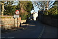
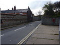
3
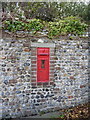
Disused VR postbox on High Street
The 'next collection' plate has been removed, so it looks like this one's out of service now.
Image: © Richard Law
Taken: 25 Oct 2010
0.02 miles
4

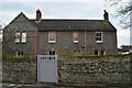
Victorian Post Office
On High Street (B1145). When the railway opened in 1889 - bringing visitors wishing to sample the fresh sea air - the village of Mundesley grew rapidly. The railway is now long gone but Mundesley is still considered to be one of the best a holiday resorts in Norfolk, offering a sandy beach with safe swimming for children when the tide is out; the East Norfolk Coast Path/Peddars Way follows the coastline and offers splendid views across the North Sea. Properties date mainly from Victorian times and many houses are constructed from traditional Norfolk materials such as flint and brick, with thatch or pantile roofs. The village contains a small number of shops, eating places, pubs, tea rooms and possibly the smallest museum in the country, the Maritime Museum > http://www.geograph.org.uk/photo/204932. For a wider view of the village see > http://www.geograph.org.uk/photo/968098. Several holiday parks are in the vicinity of the village, the largest one being Mundesley Holiday Village, located a short distance to the southeast.
Image: © Evelyn Simak
Taken: 19 Sep 2008
0.02 miles
7

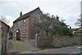
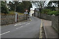
Mundesley Village Sign, Norfolk
Looking towards Gold Park.
Image: © Christine Matthews
Taken: 21 Jan 2022
0.03 miles
9

Post Office and Shop
On High Street (B1145) - this attractive building dates from Victorian times. See > http://www.geograph.org.uk/photo/969860 for a detailed view of the George VI postbox.
When the railway opened in 1889 - bringing visitors wishing to sample the fresh sea air - the village of Mundesley grew rapidly. The railway is now long gone but Mundesley is still considered to be one of the best a holiday resorts in Norfolk, offering a sandy beach with safe swimming for children when the tide is out; the East Norfolk Coast Path/Peddars Way follows the coastline and offers splendid views across the North Sea. Properties date mainly from Victorian times and many houses are constructed from traditional Norfolk materials such as flint and brick, with thatch or pantile roofs. The village contains a small number of shops, eating places, pubs, tea rooms and possibly the smallest museum in the country, the Maritime Museum > http://www.geograph.org.uk/photo/204932. For a wider view of the village see > http://www.geograph.org.uk/photo/968098. Several holiday parks are in the vicinity of the village, the largest one being Mundesley Holiday Village, located a short distance to the southeast.
Image: © Evelyn Simak
Taken: 19 Sep 2008
0.03 miles
