
IMAGES TAKEN NEAR TO
Big Yard, The Street, NORWICH, NR11 7AU
Introduction
This page details the photographs taken nearby to Big Yard, The Street, NR11 7AU by members of the Geograph project.
The Geograph project started in 2005 with the aim of publishing, organising and preserving representative images for every square kilometre of Great Britain, Ireland and the Isle of Man.

There are currently over 7.5m images from over14,400 individuals and you can help contribute to the project by visiting https://www.geograph.org.uk
Image Map
Images are licensed for reuse under creativecommons.org/licenses/by-sa/2.0
Notes
- Clicking on the map will re-center to the selected point.
- The higher the marker number, the further away the image location is from the centre of the postcode.
Image Listing (72 Images Found)
Images are licensed for reuse under creativecommons.org/licenses/by-sa/2.0
Image
Details
Distance
1

Green door
And a view along a row of gables, belonging to cottages beside Church Road.
Image: © Evelyn Simak
Taken: 8 Jul 2008
0.01 miles
2

Manor Farm House
An impressive farm house in the village of Itteringham. According to Pevsner the house dates from 1707.
Image: © Philip Halling
Taken: 14 Jul 2006
0.04 miles
3

George V postbox
Set into the wall of the Village Shop and Post Office > http://www.geograph.org.uk/photo/876149.
Image: © Evelyn Simak
Taken: 8 Jul 2008
0.05 miles
4

Itteringham Village Shop
General store, deli, Post Office, café and off licence run by the Itteringham Community Association.
Image: © Hugh Venables
Taken: 17 Jul 2021
0.05 miles
5

Bus shelter and telephone box
By the junction of Wolterton Road with Church Road.
Image: © Evelyn Simak
Taken: 8 Jul 2008
0.06 miles
6

Village Shop and Post Office
See also > http://www.geograph.org.uk/photo/17603. The Gallery appears to be no longer there but a Post Office is still operating from here, albeit only for a couple of hours per week.
Image: © Evelyn Simak
Taken: 8 Jul 2008
0.06 miles
7
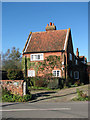
Wingfield House
On Wolterton Road, Itteringham. Wingfield House is located across the road from Manor Farm House > http://www.geograph.org.uk/photo/205574.
Image: © Evelyn Simak
Taken: 29 Oct 2008
0.07 miles
8

Bure Valley Community Centre
Beside access to Robin Farm/public footpath, leading west from Church Road.
Image: © Evelyn Simak
Taken: 8 Jul 2008
0.08 miles

10

Bure Valley Community Centre, Itteringham
Image: © Adrian S Pye
Taken: 29 Oct 2018
0.10 miles