
IMAGES TAKEN NEAR TO
Ingworth Road, NORWICH, NR11 6PT
Introduction
This page details the photographs taken nearby to Ingworth Road, NR11 6PT by members of the Geograph project.
The Geograph project started in 2005 with the aim of publishing, organising and preserving representative images for every square kilometre of Great Britain, Ireland and the Isle of Man.

There are currently over 7.5m images from over14,400 individuals and you can help contribute to the project by visiting https://www.geograph.org.uk
Image Map
Images are licensed for reuse under creativecommons.org/licenses/by-sa/2.0
Notes
- Clicking on the map will re-center to the selected point.
- The higher the marker number, the further away the image location is from the centre of the postcode.
Image Listing (10 Images Found)
Images are licensed for reuse under creativecommons.org/licenses/by-sa/2.0
Image
Details
Distance
1

Old Milestone by Keeper's Cottage, north of Aylsham
Carved stone post by the UC road, in parish of BLICKLING (BROADLAND District), by Keeper's Cottage, against garden fence, North side of track, on West side of road. Erected by an unknown authority in the 19th century.
Inscription reads:-
I
Mile to
BLICKLING
V
from
GUNTON
Norfolk HER listed. NHER Number: 31290
https://www.heritagegateway.org.uk/Gateway/Results_Single.aspx?uid=MNF31290&resourceID=1002
Milestone Society National ID: NO_BLGU01.
Image: © CW Haines
Taken: 30 May 2003
0.01 miles
2

One Mile to Blickling
... is the information given on this old milestone in front of > Image
Image: © Evelyn Simak
Taken: 9 Jan 2008
0.02 miles
3
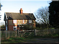
Keeper's Cottage
An old milestone just outside this picture, to the left, informs that the distance to Blickling is one mile > Image
Image: © Evelyn Simak
Taken: 9 Jan 2008
0.02 miles
4

Field edge
The old trees seen at left line the unnamed minor road to Ingworth.
Image: © Evelyn Simak
Taken: 9 Jan 2008
0.06 miles

6

Wooded lane east of Blickling Park
Image: © Christopher Hilton
Taken: 16 Aug 2014
0.15 miles

8

Squirrel's Carr - Junction with Cromer Road
Image: © Evelyn Simak
Taken: 29 Aug 2007
0.19 miles
9
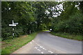
Junction of lanes south-west of Ingworth Bridge
Image: © Christopher Hilton
Taken: 16 Aug 2014
0.20 miles
10

Wheat field west of Cromer Road
Image: © Christopher Hilton
Taken: 16 Aug 2014
0.23 miles