
IMAGES TAKEN NEAR TO
Mountains Road, NORWICH, NR11 6PN
Introduction
This page details the photographs taken nearby to Mountains Road, NR11 6PN by members of the Geograph project.
The Geograph project started in 2005 with the aim of publishing, organising and preserving representative images for every square kilometre of Great Britain, Ireland and the Isle of Man.

There are currently over 7.5m images from over14,400 individuals and you can help contribute to the project by visiting https://www.geograph.org.uk
Image Map
Images are licensed for reuse under creativecommons.org/licenses/by-sa/2.0
Notes
- Clicking on the map will re-center to the selected point.
- The higher the marker number, the further away the image location is from the centre of the postcode.
Image Listing (89 Images Found)
Images are licensed for reuse under creativecommons.org/licenses/by-sa/2.0
Image
Details
Distance
1

Corpusty - railway station turned football ground
Only the station building and a platform remain of the railway station and goods yard. The station, officially known as Corpusty & Saxthorpe, was a stop on the M&GN (Midland and Great Northern Joint Railway) route between Melton Constable and Great Yarmouth. The station was closed in 1959, the bridge > http://www.geograph.org.uk/photo/1257349 is half filled-in and the trackbed removed. Some of it is buried under a playing field and some has been planted over > http://www.geograph.org.uk/photo/1257355 - most of what remains is overgrown and impassable > http://www.geograph.org.uk/photo/1257344.
The villages Corpusty and Saxthorpe, situated either side of the river Bure, merge into each other. Each village has their own church but St Andrew's > http://www.geograph.org.uk/photo/309082 serves both villages ever since Corpusty's Saint Peter's > http://www.geograph.org.uk/photo/873327 - located on the outskirts of the village and separated from it by the busy B1149 - closed and came in the care of the Friends of Friendless Churches.
Image: © Evelyn Simak
Taken: 17 Apr 2009
0.05 miles
2

Corpusty - children's playground
The children's playground and adjoining football ground are located where once the railway station and goods yard used to be. Only the station building and a platform (seen in background at left) remain of the railway station and goods yard. The station, officially known as Corpusty & Saxthorpe, was a stop on the M&GN (Midland and Great Northern Joint Railway) route between Melton Constable and Great Yarmouth. The station was closed in 1959, the bridge > http://www.geograph.org.uk/photo/1257349 is half filled-in and the trackbed removed. Some of it is buried under a playing field and some has been planted over > http://www.geograph.org.uk/photo/1257355 - most of what remains is overgrown and impassable > http://www.geograph.org.uk/photo/1257344.
The villages Corpusty and Saxthorpe, situated either side of the river Bure, merge into each other. Each village has their own church but St Andrew's > http://www.geograph.org.uk/photo/309082 serves both villages ever since Corpusty's Saint Peter's > http://www.geograph.org.uk/photo/873327 - located on the outskirts of the village and separated from it by the busy B1149 - closed and came in the care of the Friends of Friendless Churches.
Image: © Evelyn Simak
Taken: 17 Apr 2009
0.06 miles
3

Corpusty - Mill Villas
The Mill Villas were built by Samuel Goldsmith for mill workers. A wall tablet is inscribed 'S. G. 1898'. Samuel Goldsmith, who at the age of 16 in the 1851 census was already described as a miller, had the lease of Corpusty watermill > http://www.geograph.org.uk/photo/1257450. The Goldsmith family also owned two postmills in Corpusty.
The villages Corpusty and Saxthorpe, situated either side of the river Bure, merge into each other. Each village has their own church but St Andrew's > http://www.geograph.org.uk/photo/309082 serves both villages ever since Corpusty's Saint Peter's > http://www.geograph.org.uk/photo/873327 - located on the outskirts of the village and separated from it by the busy B1149 - closed and came in the care of the Friends of Friendless Churches.
Image: © Evelyn Simak
Taken: 17 Apr 2009
0.06 miles
4
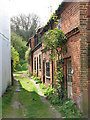
Corpusty - a narrow lane
... turning off The Street. The villages Corpusty and Saxthorpe, situated either side of the river Bure, merge into each other. Each village has their own church but St Andrew's > http://www.geograph.org.uk/photo/309082 serves both villages ever since Corpusty's Saint Peter's > http://www.geograph.org.uk/photo/873327 - located on the outskirts of the village and separated from it by the busy B1149 - closed and came in the care of the Friends of Friendless Churches.
Image: © Evelyn Simak
Taken: 17 Apr 2009
0.06 miles
5

Corpusty - the old railway station
The station, officially known as Corpusty & Saxthorpe, was a stop on the M&GN (Midland and Great Northern Joint Railway) route between Melton Constable and Great Yarmouth. The station was closed in 1959, the bridge > http://www.geograph.org.uk/photo/1257349 is half filled-in and the trackbed removed. Some of it is buried under a playing field and some has been planted over > http://www.geograph.org.uk/photo/1257355 - most of what remains is overgrown and impassable > http://www.geograph.org.uk/photo/1257344.
The villages Corpusty and Saxthorpe, situated either side of the river Bure, merge into each other. Each village has their own church but St Andrew's > http://www.geograph.org.uk/photo/309082 serves both villages ever since Corpusty's Saint Peter's > http://www.geograph.org.uk/photo/873327 - located on the outskirts of the village and separated from it by the busy B1149 - closed and came in the care of the Friends of Friendless Churches.
Image: © Evelyn Simak
Taken: 17 Apr 2009
0.06 miles
6

Corpusty and Saxthorpe Village Hall
It is located in Station Road, adjoining the former railway station > http://www.geograph.org.uk/photo/1257413 and goods yard, now a playing field. The red brick building seen in the background is Mill Villas > http://www.geograph.org.uk/photo/1257402.
The villages Corpusty and Saxthorpe, situated either side of the river Bure, merge into each other. Each village has their own church but St Andrew's > http://www.geograph.org.uk/photo/309082 serves both villages ever since Corpusty's Saint Peter's > http://www.geograph.org.uk/photo/873327 - located on the outskirts of the village and separated from it by the busy B1149 - closed and came in the care of the Friends of Friendless Churches.
Image: © Evelyn Simak
Taken: 17 Apr 2009
0.07 miles
7
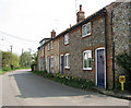
Corpusty - flint and brick cottages
These attractive cottages line The Street. The villages Corpusty and Saxthorpe, situated either side of the river Bure, merge into each other. Each village has their own church but St Andrew's > http://www.geograph.org.uk/photo/309082 serves both villages ever since Corpusty's Saint Peter's > http://www.geograph.org.uk/photo/873327 - located on the outskirts of the village and separated from it by the busy B1149 - closed and came in the care of the Friends of Friendless Churches.
Image: © Evelyn Simak
Taken: 17 Apr 2009
0.07 miles
8
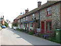
Corpusty - flint and brick cottages
View east along The Street. The villages Corpusty and Saxthorpe, situated either side of the river Bure, merge into each other. Each village has their own church but St Andrew's > http://www.geograph.org.uk/photo/309082 serves both villages ever since Corpusty's Saint Peter's > http://www.geograph.org.uk/photo/873327 - located on the outskirts of the village and separated from it by the busy B1149 - closed and came in the care of the Friends of Friendless Churches.
Image: © Evelyn Simak
Taken: 17 Apr 2009
0.08 miles
9

Corpusty and Saxthorpe Railway Station
Only the station building and a platform remain of the railway station and goods yard. The station, officially known as Corpusty & Saxthorpe, was a stop on the M&GN (Midland and Great Northern Joint Railway) route between Melton Constable and Great Yarmouth. The station was closed in 1959, the bridge > http://www.geograph.org.uk/photo/1257349 is half filled-in and the trackbed removed. Some of it is buried under a playing field and some has been planted over > http://www.geograph.org.uk/photo/1257355 - most of what remains is overgrown and impassable > http://www.geograph.org.uk/photo/1257344.
The villages Corpusty and Saxthorpe, situated either side of the river Bure, merge into each other. Each village has their own church but St Andrew's > http://www.geograph.org.uk/photo/309082 serves both villages ever since Corpusty's Saint Peter's > http://www.geograph.org.uk/photo/873327 - located on the outskirts of the village and separated from it by the busy B1149 - closed and came in the care of the Friends of Friendless Churches.
Image: © Evelyn Simak
Taken: 17 Apr 2009
0.08 miles
10

Corpusty railway station - all that remains
Only the station building and a platform remain of the railway station and goods yard. The station, officially known as Corpusty & Saxthorpe, was a stop on the M&GN (Midland and Great Northern Joint Railway) route between Melton Constable and Great Yarmouth. The station was closed in 1959, the bridge > http://www.geograph.org.uk/photo/1257349 is half filled-in and the trackbed removed. Some of it is buried under a playing field and some has been planted over > http://www.geograph.org.uk/photo/1257355 - most of what remains is overgrown and impassable > http://www.geograph.org.uk/photo/1257344.
The villages Corpusty and Saxthorpe, situated either side of the river Bure, merge into each other. Each village has their own church but St Andrew's > http://www.geograph.org.uk/photo/309082 serves both villages ever since Corpusty's Saint Peter's > http://www.geograph.org.uk/photo/873327 - located on the outskirts of the village and separated from it by the busy B1149 - closed and came in the care of the Friends of Friendless Churches.
Image: © Evelyn Simak
Taken: 17 Apr 2009
0.08 miles