IMAGES TAKEN NEAR TO
Tunstead Road, NORWICH, NR10 5DA
Introduction
This page details the photographs taken nearby to Tunstead Road, NR10 5DA by members of the Geograph project.
The Geograph project started in 2005 with the aim of publishing, organising and preserving representative images for every square kilometre of Great Britain, Ireland and the Isle of Man.

There are currently over 7.5m images from over14,400 individuals and you can help contribute to the project by visiting https://www.geograph.org.uk
Image Map
Images are licensed for reuse under creativecommons.org/licenses/by-sa/2.0
Notes
- Clicking on the map will re-center to the selected point.
- The higher the marker number, the further away the image location is from the centre of the postcode.
Image Listing (26 Images Found)
Images are licensed for reuse under creativecommons.org/licenses/by-sa/2.0
Image
Details
Distance
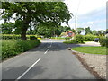
4
The road to Scottow
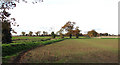
The road which can be seen here - its course is denoted by the solitary trees growing alongside it - links the villages of Scottow and Tunstead, further to the east. For some inexplicable reason a short section of this single track road splits into two lanes - roughly mid-way between these two villages - which are separated from each other by a strip of grass and mature trees growing on it, forming a dual carriageway > http://www.geograph.org.uk/photo/1046148.
This view was taken from a public footpath which turns off Roman Road > http://www.geograph.org.uk/photo/1045976 - http://www.geograph.org.uk/photo/1045981 and leads in southerly direction, passing Home Farmhouse > http://www.geograph.org.uk/photo/1045985. A short distance further south the concreted farm road > http://www.geograph.org.uk/photo/1045981 ends and the path enters a tunnel, the walls of which are formed by a hedge interspersed by trees, on either side.
Image: © Evelyn Simak
Taken: 15 Nov 2008
0.06 miles
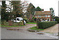
5
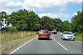
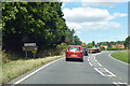
B1150 towards North Walsham
Agricultural traffic.
Image: © Robin Webster
Taken: 11 Aug 2018
0.08 miles
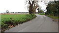
8
B1150 towards North Walsham
Agricultural traffic.
Image: © Robin Webster
Taken: 11 Aug 2018
0.11 miles
9
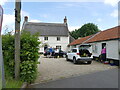
Three Horseshoes House
Dwelling converted from former Three Horseshoes Pub
Image: © David Pashley
Taken: 7 Jun 2022
0.13 miles