
IMAGES TAKEN NEAR TO
Schoolfield, NORWICH, NR10 4SN
Introduction
This page details the photographs taken nearby to Schoolfield, NR10 4SN by members of the Geograph project.
The Geograph project started in 2005 with the aim of publishing, organising and preserving representative images for every square kilometre of Great Britain, Ireland and the Isle of Man.

There are currently over 7.5m images from over14,400 individuals and you can help contribute to the project by visiting https://www.geograph.org.uk
Image Map
Images are licensed for reuse under creativecommons.org/licenses/by-sa/2.0
Notes
- Clicking on the map will re-center to the selected point.
- The higher the marker number, the further away the image location is from the centre of the postcode.
Image Listing (41 Images Found)
Images are licensed for reuse under creativecommons.org/licenses/by-sa/2.0
Image
Details
Distance
2
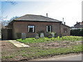
Primitive Methodist Chapel
This chapel is located on the corner of Chapel Lane and Mill Lane. There once used to be a dwelling house attached to it, meantime demolished because it was deemed too small for modern living standards. The hedge surrounding the premises has recently been removed. Members of the family who owned the adjacent farm are buried here and the chapel is still used by a handful of regular worshippers.
Image: © Evelyn Simak
Taken: 31 Mar 2008
0.08 miles
3
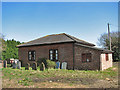
Primitive Methodist Chapel
This chapel is located on the corner of Chapel Lane and Mill Lane. There once used to be a dwelling house attached to it, meantime demolished because it was deemed too small for modern living standards. The hedge surrounding the premises has recently been removed. Members of the family who owned the adjacent farm are buried here and the chapel is still used by a congregation numbering a handful of regular worshippers.
Image: © Evelyn Simak
Taken: 31 Mar 2008
0.08 miles
4
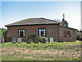
Primitive Methodist Chapel
This chapel is located on the corner of Chapel Lane and Mill Lane. There once used to be a dwelling house attached to it, meantime demolished because it was deemed too small for modern living standards. The hedge surrounding the premises has recently been removed. Members of the family who owned the adjacent farm are buried here and the chapel is still used by a handful of regular worshippers.
Image: © Evelyn Simak
Taken: 31 Mar 2008
0.09 miles
5
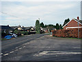
Taverham Road junction with Church Road
Image: © Evelyn Simak
Taken: 25 Jan 2008
0.11 miles
6
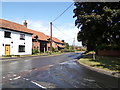
The Street, Felthorpe
At the junction with Taversham Road
Road No.C245
Image: © Geographer
Taken: 5 Aug 2019
0.11 miles
7
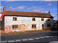
Mill Farmhouse
On The Street at the junction with Mill Lane
Image: © Geographer
Taken: 26 Sep 2013
0.11 miles
8
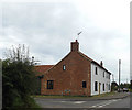
Mill Farmhouse, Felthorpe
On The Street at the junction with Mill Lane & Taverham Road
Image: © Geographer
Taken: 2 Jul 2015
0.12 miles
9
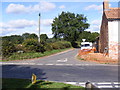
Mill Lane, Felthorpe
At the junction with The Street
Image: © Geographer
Taken: 26 Sep 2013
0.12 miles
10
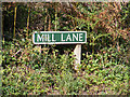
Mill Lane sign
On Mill Lane at the junction with The Street
Image: © Geographer
Taken: 26 Sep 2013
0.12 miles