
IMAGES TAKEN NEAR TO
Whitwell Street, NORWICH, NR10 4RA
Introduction
This page details the photographs taken nearby to Whitwell Street, NR10 4RA by members of the Geograph project.
The Geograph project started in 2005 with the aim of publishing, organising and preserving representative images for every square kilometre of Great Britain, Ireland and the Isle of Man.

There are currently over 7.5m images from over14,400 individuals and you can help contribute to the project by visiting https://www.geograph.org.uk
Image Map
Images are licensed for reuse under creativecommons.org/licenses/by-sa/2.0
Notes
- Clicking on the map will re-center to the selected point.
- The higher the marker number, the further away the image location is from the centre of the postcode.
Image Listing (21 Images Found)
Images are licensed for reuse under creativecommons.org/licenses/by-sa/2.0
Image
Details
Distance
1
Glimpsed through the hedge
The buildings seen in the background (in adjacent grid square) are located on Whitwell Street. Whitwell Street adjoins Reepham in the southeast. Whitwell has its own Hall and its church, dedicated to St Michael > http://www.geograph.org.uk/photo/766121 shares a site with two others - St Mary's of Reepham and the ruined All Saints, Hackford.
Image: © Evelyn Simak
Taken: 15 Apr 2009
0.05 miles
2
Approaching Whitwell Street
Whitwell Street adjoins Reepham in the southeast. Whitwell has its own Hall and its church, dedicated to St Michael > http://www.geograph.org.uk/photo/766121 shares a site with two others - St Mary's of Reepham and the ruined All Saints, Hackford.
Image: © Evelyn Simak
Taken: 15 Apr 2009
0.08 miles
3
Rural lane in Whitwell Street
Whitwell Street adjoins Reepham in the southeast. Whitwell has its own Hall and its church, dedicated to St Michael > http://www.geograph.org.uk/photo/766121 shares a site with two others - St Mary's of Reepham and the ruined All Saints, Hackford.
Image: © Evelyn Simak
Taken: 15 Apr 2009
0.10 miles
4
Cottages in Whitwell Street
A path traversing the field seen in the foreground starts here > http://www.geograph.org.uk/photo/1253947.
Whitwell Street adjoins Reepham in the southeast. Whitwell has its own Hall and its church, dedicated to St Michael > http://www.geograph.org.uk/photo/766121 shares a site with two others - St Mary's of Reepham and the ruined All Saints, Hackford.
Image: © Evelyn Simak
Taken: 15 Apr 2009
0.12 miles
5
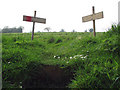
Stepping into a field
For easier access up to a narrow path which serves as a shortcut, steps were built into the embankment beside the road, with markers placed at both sides. The path starts opposite a property called Windy Ridge > http://www.geograph.org.uk/photo/1253950.
Image: © Evelyn Simak
Taken: 15 Apr 2009
0.12 miles
6
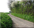
Tall hedge beside rural lane
This lane leads to the hamlet of Whitwell Street which adjoins Reepham in the southeast. Whitwell has its own Hall and its church, dedicated to St Michael > http://www.geograph.org.uk/photo/766121 shares a site with two others - St Mary's of Reepham and the ruined All Saints, Hackford.
Image: © Evelyn Simak
Taken: 15 Apr 2009
0.12 miles
7
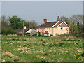
Cottages in Whitwell Street
This view was taken from a narrow path which traverses the field seen in the foreground. Whitwell Street adjoins Reepham in the southeast. Whitwell has its own Hall and its church, dedicated to St Michael > http://www.geograph.org.uk/photo/766121 shares a site with two others - St Mary's of Reepham and the ruined All Saints, Hackford.
Image: © Evelyn Simak
Taken: 15 Apr 2009
0.14 miles
8
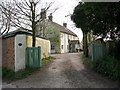
Entrance to Ivy House
... in Whitwell Street. Whitwell Street adjoins Reepham in the southeast. Whitwell has its own Hall and its church, dedicated to St Michael > http://www.geograph.org.uk/photo/766121 shares a site with two others - St Mary's of Reepham and the ruined All Saints, Hackford.
Image: © Evelyn Simak
Taken: 15 Apr 2009
0.17 miles
9
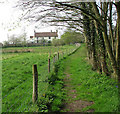
Path to Whitwell Street
This public footpath links Whitwell Street with Manor Farm, further to the southeast. The house seen in the background is Ivy House. Whitwell Street adjoins Reepham in the southeast. Whitwell has its own Hall and its church, dedicated to St Michael > http://www.geograph.org.uk/photo/766121 shares a site with two others - St Mary's of Reepham and the ruined All Saints, Hackford.
Image: © Evelyn Simak
Taken: 15 Apr 2009
0.17 miles
10
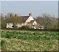
Flowering tree in garden
View towards Ivy House, located in Whitwell Street. This view was taken from the path which traverses the field seen in the foreground. Whitwell Street adjoins Reepham in the southeast. Whitwell has its own Hall and its church, dedicated to St Michael > http://www.geograph.org.uk/photo/766121 shares a site with two others - St Mary's of Reepham and the ruined All Saints, Hackford.
Image: © Evelyn Simak
Taken: 15 Apr 2009
0.17 miles