
IMAGES TAKEN NEAR TO
Laburnum Grove, NORWICH, NR10 4LY
Introduction
This page details the photographs taken nearby to Laburnum Grove, NR10 4LY by members of the Geograph project.
The Geograph project started in 2005 with the aim of publishing, organising and preserving representative images for every square kilometre of Great Britain, Ireland and the Isle of Man.

There are currently over 7.5m images from over14,400 individuals and you can help contribute to the project by visiting https://www.geograph.org.uk
Image Map
Images are licensed for reuse under creativecommons.org/licenses/by-sa/2.0
Notes
- Clicking on the map will re-center to the selected point.
- The higher the marker number, the further away the image location is from the centre of the postcode.
Image Listing (24 Images Found)
Images are licensed for reuse under creativecommons.org/licenses/by-sa/2.0
Image
Details
Distance
1
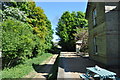
Reepham Railway Station
The former Reepham railway station is located about 1 kilometre north of the centre of Reepham, by the B1145 to Aylsham. The station was opened in 1881; closed to passengers in 1952 it became redundant when closed to goods services also, in 1964. A section of the Marriott's Way, a long distance foot and cycle path, now follows the former railway trackbed.
Image: © Ashley Dace
Taken: 1 May 2011
0.07 miles
2
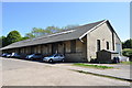
Reepham Goods Shed
The former Reepham railway station is located about 1 kilometre north of the centre of Reepham, by the B1145 to Aylsham. The station was opened in 1881; closed to passengers in 1952 it became redundant when closed to goods services also, in 1964. A section of the Marriott's Way, a long distance foot and cycle path, now follows the former railway trackbed.
Image: © Ashley Dace
Taken: 1 May 2011
0.07 miles
3
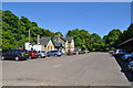
Reepham Railway Station
The former Reepham railway station is located about 1 kilometre north of the centre of Reepham, by the B1145 to Aylsham. The station was opened in 1881; closed to passengers in 1952 it became redundant when closed to goods services also, in 1964. A section of the Marriott's Way, a long distance foot and cycle path, now follows the former railway trackbed.
Image: © Ashley Dace
Taken: 1 May 2011
0.07 miles
4
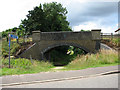
Bridge over Marriott's Way
Seen from Wood Dalling Road. The bridge leads over the former railway track, the trackbed of which now forms a section of the Marriott's Way, a long-distance foot and cycle path.
Image: © Evelyn Simak
Taken: 19 Jul 2008
0.09 miles
5
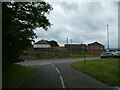
Commercial buildings, Reepham Moor
Part of a small trading estate
Image: © David Smith
Taken: 12 Jun 2024
0.09 miles
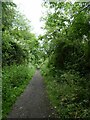
7
Approaching Wood Dalling Road on the Marriott's Way
The view is easterly.
Image: © Evelyn Simak
Taken: 19 Jul 2008
0.10 miles
8
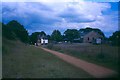
Reepham old station
The trackbed of the old railway has now been converted into the Marriott's Way cycle route
Image: © Ron Strutt
Taken: 22 Jun 1999
0.10 miles
9
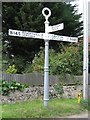
Direction Sign ? Signpost
Located on the north side of the junction of the B1145 Cawston Road and Orchard Lane in Reepham parish. 3 arms and annulus finial.
Milestone Society National ID: NO_TG1023
Image: © J Young
Taken: 24 Jul 2004
0.10 miles
10
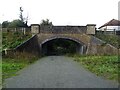
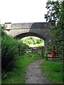
Bridge over disused railway, Reepham
Trackbed is now used by the Marriott's Way, a long distance foot and cycle path.
Image: © JThomas
Taken: 10 Oct 2024
0.10 miles