IMAGES TAKEN NEAR TO
Ollands Road, NORWICH, NR10 4EL
Introduction
This page details the photographs taken nearby to Ollands Road, NR10 4EL by members of the Geograph project.
The Geograph project started in 2005 with the aim of publishing, organising and preserving representative images for every square kilometre of Great Britain, Ireland and the Isle of Man.

There are currently over 7.5m images from over14,400 individuals and you can help contribute to the project by visiting https://www.geograph.org.uk
Image Map
Images are licensed for reuse under creativecommons.org/licenses/by-sa/2.0
Notes
- Clicking on the map will re-center to the selected point.
- The higher the marker number, the further away the image location is from the centre of the postcode.
Image Listing (179 Images Found)
Images are licensed for reuse under creativecommons.org/licenses/by-sa/2.0
Image
Details
Distance
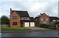
3
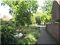
Footpath at Reepham
Presumably the garden on the left belongs to the house on the right.
Image: © Jonathan Thacker
Taken: 4 Jun 2012
0.13 miles
4
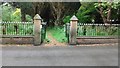
Reepham - with - Kerdiston Old Cemetery
The old cemetery for Reepham, Norfolk. Used from 1856 to 1935. Now open for visitors to look around.
Image: © Jeremy Osborne
Taken: 25 May 2016
0.13 miles
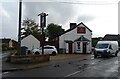
6
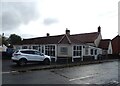
The Cutting Station, Reepham
Hairdresser on Station Plain.
Image: © JThomas
Taken: 10 Oct 2024
0.14 miles
7
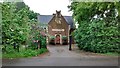
Old St Mary's School, Reepham
St Mary's School, Reepham, built in 1847. Now a private dwelling.
Image: © Jeremy Osborne
Taken: 25 May 2016
0.14 miles
8
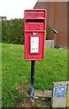
Elizabeth II postbox on Station Road, Reepham
Postbox No. NR10 1018.
Image: © JThomas
Taken: 10 Oct 2024
0.15 miles
10
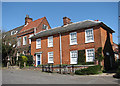
Georgian houses on the Market Place
Reepham is an attractive Georgian market town which has had its status since 1277; by the 18th century the Reepham brewery was established and the market was supported by a maximum of thirteen public houses. Three churches share the same churchyard: Reepham's church of St. Mary is joined by its choir vestry to St. Michael’s (facing the Market Place, once serving the parish of Whitwell), and a third church, burned down in 1543) that belonged to Hackford. Only a fragment of the tower wall remains. Many of the buildings around the Market Place retain the wattle and daub, flint and brick and clay lump of even earlier buildings, many of which were rebuilt in Georgian and Victorian times. Reepham is a significant stop on the Marriott's Way cycle and footpath.
Image: © Evelyn Simak
Taken: 15 Apr 2008
0.15 miles