IMAGES TAKEN NEAR TO
Rosetta Road, NORWICH, NR10 3NW

Introduction

This page details the photographs taken nearby to Rosetta Road, NR10 3NW by members of the Geograph project.

The Geograph project started in 2005 with the aim of publishing, organising and preserving representative images for every square kilometre of Great Britain, Ireland and the Isle of Man.

There are currently over 7.5m images from over14,400 individuals and you can help contribute to the project by visiting https://www.geograph.org.uk

Image Map


Images are licensed for reuse under creativecommons.org/licenses/by-sa/2.0
Notes
  • Clicking on the map will re-center to the selected point.
  • The higher the marker number, the further away the image location is from the centre of the postcode.

Image Listing (8 Images Found)

Images are licensed for reuse under creativecommons.org/licenses/by-sa/2.0
Image
Details
Distance
1
The Post Office in Crostwick Lane
Image: © Evelyn Simak Taken: 17 Sep 2007
0.11 miles
2
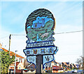
Spixworth village sign
The sign reflects the village's rural heritage with the church being depicted, fronted by lots of animals, while the early settlements at the village are also represented. Underneath that, the sign shows all the coats of arms of the families based in the village, dating from 1066. On the other side of the sign, there is a carving of Spixworth Hall, an Elizabethan edifice which was owned by the Longe family from 1693 to 1952. https://www.geograph.org.uk/photo/2274431
Image: © Adrian S Pye Taken: 25 Jan 2021
0.13 miles
3
Crostwick Lane, Spixworth and Village sign
For a closer look at the sign goto > Image
Image: © Adrian S Pye Taken: 18 Feb 2011
0.17 miles
4
Spixworth village sign
The sign reflects the village's rural heritage with the church being depicted, fronted by lots of animals, while the early settlements at the village are also represented. Underneath that, the sign shows all the coats of arms of the families based in the village, dating from 1066. On the other side of the sign, there is a carving of Spixworth Hall, an Elizabethan edifice which was owned by the Longe family from 1693 to 1952. The ghostly nightwatchman stands at the gate, and four more coats of arms appear beneath the name. In the drive is a horse driven hearse represents the many generations of the Longe family who lived and died at the Hall. The coats of arms are:- [side a] Pottiers (1066), Bardolph (1199), Mapes (1485), Peck (1602), [side b] Longe (1693), Frere (1718), Howes (1853), Chittock (1927).
Image: © Adrian S Pye Taken: 18 Feb 2011
0.17 miles
5
B1150 towards Coltishall
Image: © Robin Webster Taken: 11 Aug 2018
0.18 miles
6
West past houses on Crostwick Lane
Image: © Evelyn Simak Taken: 17 Sep 2007
0.18 miles
7
The Spixworth Motel
Image: © Evelyn Simak Taken: 17 Sep 2007
0.21 miles
8
Crostwick Lane seen from west to east
Image: © Evelyn Simak Taken: 17 Sep 2007
0.23 miles