
IMAGES TAKEN NEAR TO
Old Norwich Road, NORWICH, NR10 3JF
Introduction
This page details the photographs taken nearby to Old Norwich Road, NR10 3JF by members of the Geograph project.
The Geograph project started in 2005 with the aim of publishing, organising and preserving representative images for every square kilometre of Great Britain, Ireland and the Isle of Man.

There are currently over 7.5m images from over14,400 individuals and you can help contribute to the project by visiting https://www.geograph.org.uk
Image Map
Images are licensed for reuse under creativecommons.org/licenses/by-sa/2.0
Notes
- Clicking on the map will re-center to the selected point.
- The higher the marker number, the further away the image location is from the centre of the postcode.
Image Listing (16 Images Found)
Images are licensed for reuse under creativecommons.org/licenses/by-sa/2.0
Image
Details
Distance
1

Abbey Road
This view was taken in easterly direction along Abbey Road, which links Back Street with West Lane.
Horsham and Newton St Faith are situated about 6 miles north of Norwich. The church of SS Mary and Andrew > http://www.geograph.org.uk/photo/1191886 located in the grounds of a ruined 13th century priory, serves both Church of England and Methodist worshippers. There are two Post Offices (one serving each village), one restaurant and two public hostelries. For more information and old photographs see http://www.st-faith.co.uk/
Image: © Evelyn Simak
Taken: 5 Mar 2009
0.19 miles
2

Red-brick cottages in Abbey Road
Horsham and Newton St Faith are situated about 6 miles north of Norwich. The church of SS Mary and Andrew > http://www.geograph.org.uk/photo/1191886 located in the grounds of a ruined 13th century priory, serves both Church of England and Methodist worshippers. There are two Post Offices (one serving each village), one restaurant and two public hostelries. For more information and old photographs see http://www.st-faith.co.uk/
Image: © Evelyn Simak
Taken: 5 Mar 2009
0.19 miles
3

View south (uphill) along Back Street
Horsham and Newton St Faith are situated about 6 miles north of Norwich. The church of SS Mary and Andrew > http://www.geograph.org.uk/photo/1191886 located in the grounds of a ruined 13th century priory, serves both Church of England and Methodist worshippers. There are two Post Offices (one serving each village), one restaurant and two public hostelries. For more information and old photographs see http://www.st-faith.co.uk/
Image: © Evelyn Simak
Taken: 5 Mar 2009
0.20 miles
4

St Faith's Post Office & Stores
St Faith's Post Office is located in Back Street. Horsham and Newton St Faith are situated about 6 miles north of Norwich. The church of SS Mary and Andrew > http://www.geograph.org.uk/photo/1191886 located in the grounds of a ruined 13th century priory, serves both Church of England and Methodist worshippers. There are two Post Offices (one serving each village), one restaurant and two public hostelries. For more information and old photographs see http://www.st-faith.co.uk/
Image: © Evelyn Simak
Taken: 5 Mar 2009
0.20 miles
5

Back Street
View north along Back Street, approaching Crown Road.
Horsham and Newton St Faith are situated about 6 miles north of Norwich. The church of SS Mary and Andrew > http://www.geograph.org.uk/photo/1191886 located in the grounds of a ruined 13th century priory, serves both Church of England and Methodist worshippers. There are two Post Offices (one serving each village), one restaurant and two public hostelries. For more information and old photographs see http://www.st-faith.co.uk/
Image: © Evelyn Simak
Taken: 5 Mar 2009
0.21 miles
7
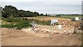
View along the Northern Distributor Road (NDR)
Looking in north-easterly direction from Old Norwich Road towards Bullock Hill. The NDR here closely follows the northern perimeter of Norwich International Airport, at times only about 20 metres distant.
Image: © Evelyn Simak
Taken: 23 Jul 2016
0.22 miles
8

View north (downhill) along Back Street
Horsham and Newton St Faith are situated about 6 miles north of Norwich. The church of SS Mary and Andrew > http://www.geograph.org.uk/photo/1191886 located in the grounds of a ruined 13th century priory, serves both Church of England and Methodist worshippers. There are two Post Offices (one serving each village), one restaurant and two public hostelries. For more information and old photographs see http://www.st-faith.co.uk/
Image: © Evelyn Simak
Taken: 5 Mar 2009
0.22 miles
9

The Kings Head - car park
Viewed from Back Street. For a view of the pub's frontage see > http://www.geograph.org.uk/photo/1191890. The tower of the church of SS Mary & Andrew > http://www.geograph.org.uk/photo/1191886 can be seen above the rooftops.
Horsham and Newton St Faith are situated about 6 miles north of Norwich. The church of SS Mary and Andrew, located in the grounds of a ruined 13th century priory, serves both Church of England and Methodist worshippers. There are two Post Offices (one serving each village), one restaurant and two public hostelries. For more information and old photographs see http://www.st-faith.co.uk/
Image: © Evelyn Simak
Taken: 5 Mar 2009
0.24 miles
10
Back Street, Horsham St.Faith
Near Horsham St.Faith Post Office Stores
Image: © Geographer
Taken: 2 Jul 2015
0.24 miles