IMAGES TAKEN NEAR TO
Willow Way, NORWICH, NR10 3GE
Introduction
This page details the photographs taken nearby to Willow Way, NR10 3GE by members of the Geograph project.
The Geograph project started in 2005 with the aim of publishing, organising and preserving representative images for every square kilometre of Great Britain, Ireland and the Isle of Man.

There are currently over 7.5m images from over14,400 individuals and you can help contribute to the project by visiting https://www.geograph.org.uk
Image Map
Images are licensed for reuse under creativecommons.org/licenses/by-sa/2.0
Notes
- Clicking on the map will re-center to the selected point.
- The higher the marker number, the further away the image location is from the centre of the postcode.
Image Listing (28 Images Found)
Images are licensed for reuse under creativecommons.org/licenses/by-sa/2.0
Image
Details
Distance
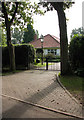
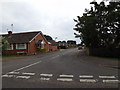
1
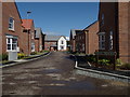
Rowan Crescent, Horsford
At the junction with Flag Cutters Way
Image: © Geographer
Taken: 5 Aug 2019
0.02 miles
4
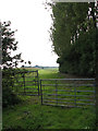
Field gate
Beside Green Lane; the track beyond leads past a field planted with maize. Green Lane turns off the B1149, leading east past North Farm > http://www.geograph.org.uk/photo/970935 and Green Lane Farm > http://www.geograph.org.uk/photo/970978 from where it turns into an unsurfaced track > http://www.geograph.org.uk/photo/970989 which traverses Lodge Hill Larch Plantation > http://www.geograph.org.uk/photo/389008 and Gravelpit Plantation > http://www.geograph.org.uk/photo/557368 passing Heath Farm. A surfaced road again in its easternmost section the lane connects with the A140 by Horsham St Faith.
Image: © Evelyn Simak
Taken: 20 Sep 2008
0.07 miles
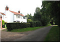
5
Property on Green Lane
Green Lane turns off the B1149, leading east past North Farm and Green Lane Farm; from where it turns into an unsurfaced track > http://www.geograph.org.uk/photo/970989 which traverses Lodge Hill Larch Plantation > http://www.geograph.org.uk/photo/389008 and Gravelpit Plantation > http://www.geograph.org.uk/photo/557368 passing Heath Farm. A surfaced road again in its easternmost section the lane connects with the A140 by Horsham St Faith.
Image: © Evelyn Simak
Taken: 20 Sep 2008
0.08 miles
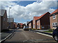
6
Green Lane past North Farm
Green Lane turns off the B1149, leading east past North Farm and Green Lane Farm > http://www.geograph.org.uk/photo/970978 from where it turns into an unsurfaced track > http://www.geograph.org.uk/photo/970989 which traverses Lodge Hill Larch Plantation > http://www.geograph.org.uk/photo/389008 and Gravelpit Plantation > http://www.geograph.org.uk/photo/557368 passing Heath Farm. A surfaced road again in its easternmost section the lane connects with the A140 by Horsham St Faith.
Image: © Evelyn Simak
Taken: 20 Sep 2008
0.11 miles
7
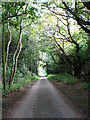
View east along Green Lane
Green Lane turns off the B1149, leading east past North Farm > http://www.geograph.org.uk/photo/970935 and Green Lane Farm > http://www.geograph.org.uk/photo/970978 from where it turns into an unsurfaced track > http://www.geograph.org.uk/photo/970989 which traverses Lodge Hill Larch Plantation > http://www.geograph.org.uk/photo/389008 and Gravelpit Plantation > http://www.geograph.org.uk/photo/557368 passing Heath Farm. A surfaced road again in its easternmost section the lane connects with the A140 by Horsham St Faith.
Image: © Evelyn Simak
Taken: 20 Sep 2008
0.14 miles
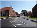
8
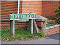
Olive Crescent sign
On Olive Crescent at the junction with the B1149 Holt road
Image: © Geographer
Taken: 26 Sep 2013
0.15 miles
9
Olive Crescent, Horsford
At the junction with the B1149 Holt Road
Image: © Geographer
Taken: 2 Jul 2015
0.15 miles
10
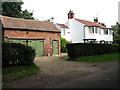
North Farm
On Green Lane - a cul-de-sac turning off the B1149. Green Lane turns off the B1149, leading east past North Farm and Green Lane Farm > http://www.geograph.org.uk/photo/970978 from where it turns into an unsurfaced track > http://www.geograph.org.uk/photo/970989 which traverses Lodge Hill Larch Plantation > http://www.geograph.org.uk/photo/389008 and Gravelpit Plantation > http://www.geograph.org.uk/photo/557368 passing Heath Farm. A surfaced road again in its easternmost section the lane connects with the A140 by Horsham St Faith.
Image: © Evelyn Simak
Taken: 20 Sep 2008
0.15 miles