
IMAGES TAKEN NEAR TO
Reepham Road, NORWICH, NR10 3AJ
Introduction
This page details the photographs taken nearby to Reepham Road, NR10 3AJ by members of the Geograph project.
The Geograph project started in 2005 with the aim of publishing, organising and preserving representative images for every square kilometre of Great Britain, Ireland and the Isle of Man.

There are currently over 7.5m images from over14,400 individuals and you can help contribute to the project by visiting https://www.geograph.org.uk
Image Map
Images are licensed for reuse under creativecommons.org/licenses/by-sa/2.0
Notes
- Clicking on the map will re-center to the selected point.
- The higher the marker number, the further away the image location is from the centre of the postcode.
Image Listing (24 Images Found)
Images are licensed for reuse under creativecommons.org/licenses/by-sa/2.0
Image
Details
Distance
1
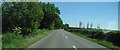
Reepham Road looking SE
Reepham Road travelling south-east near Drayton, Norfolk.
Image: © Jeremy Osborne
Taken: 2 Jun 2010
0.05 miles
3
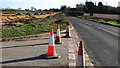
Reepham Road past Bugg's Grave
Bugg’s Grave is the name of a crossroads at the junctions of Reepham Road and Drayton Lane, on the border of the parish of Drayton. The name is shown on the 1st edition OS map dating from 1838 and continues to be in use on current maps. Any information regarding Bugg, when the burial took place, and why, has been lost over time but it can safely be assumed that the name and location were deemed to be of importance and well known locally to the extent that it was felt necessary to mark it on the map.
Crossroad burials go back a very long way and it has been documented that people were buried at crossroads, especially crossroads at parish or settlement boundaries, for reasons of superstition such as that the person was insane, guilty of witchcraft or had committed murder or "self murder", ie suicide. The custom of burying suicides at crossroads was abolished by Act of Parliament in 1823.
Image: © Evelyn Simak
Taken: 26 Dec 2016
0.10 miles
4
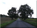
Drayton Lane, Drayton
Near the junction with Reepham Road
Road no.C282
Image: © Geographer
Taken: 26 Sep 2013
0.13 miles
5
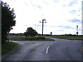
Drayton Lane, Drayton
At the junction with Reepham Road at Bugg's Grave
Road no.C282
Image: © Geographer
Taken: 26 Sep 2013
0.15 miles
6
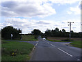
Reepham Road, Drayton
At the junction with Drayton Lane
Road no.C261
Image: © Geographer
Taken: 26 Sep 2013
0.15 miles
7
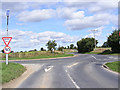
Drayton Lane, Drayton
At the junction with Reepham Road
Road no.C282
Image: © Geographer
Taken: 26 Sep 2013
0.15 miles
8
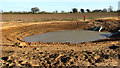
Landscaping beside Drayton Lane
The lane is permanently closed due to the construction of the Norwich Northern Distributor Road which will cut through it. This view shows one of the surface water attenuation lagoons which can be seen along the route of the new road.
Image: © Evelyn Simak
Taken: 26 Dec 2016
0.15 miles
9
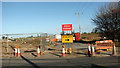
The southern end of Drayton Lane
The lane is permanently closed due to the construction of the Norwich Northern Distributor Road which will cut through it.
Image: © Evelyn Simak
Taken: 26 Dec 2016
0.16 miles
10
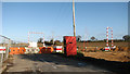
Guard hut beside Drayton Lane
The lane is permanently closed due to the construction of the Norwich Northern Distributor Road which will cut through it.
Image: © Evelyn Simak
Taken: 26 Dec 2016
0.17 miles