IMAGES TAKEN NEAR TO
St. Marys Close, ABERGAVENNY, NP7 9YE
Introduction
This page details the photographs taken nearby to St. Marys Close, NP7 9YE by members of the Geograph project.
The Geograph project started in 2005 with the aim of publishing, organising and preserving representative images for every square kilometre of Great Britain, Ireland and the Isle of Man.

There are currently over 7.5m images from over14,400 individuals and you can help contribute to the project by visiting https://www.geograph.org.uk
Image Map
Images are licensed for reuse under creativecommons.org/licenses/by-sa/2.0
Notes
- Clicking on the map will re-center to the selected point.
- The higher the marker number, the further away the image location is from the centre of the postcode.
Image Listing (43 Images Found)
Images are licensed for reuse under creativecommons.org/licenses/by-sa/2.0
Image
Details
Distance
1
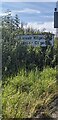
Partly hidden village name sign, Llanvair Kilgeddin, Monmouthshire
Obscured by vegetation in July 2024, the sign alongside the B4598 shows that
the village name is Llanvair Kilgeddin in English, Llanfair Cilgedin in Welsh.
Image: © Jaggery
Taken: 14 Jul 2024
0.04 miles
2
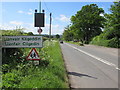
Llanvair Kilgeddin boundary sign, Monmouthshire
The boundary sign is alongside the B4598.
Llanvair Kilgeddin is a small village between Usk and Abergavenny.
The village is also Llanfair Kilgeddin in English and Llanfair Cilgedin in Welsh.
Image: © Jaggery
Taken: 14 May 2017
0.04 miles
3
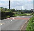
From 50 to 40 on the B4598, Llanfair Kilgeddin, Monmouthshire
The 50mph speed limit on the B4598 drops to 40mph on the approach to the main residential part of the village. The village boundary sign http://www.geograph.org.uk/photo/5394601 is in the background.
Image: © Jaggery
Taken: 14 May 2017
0.05 miles
4
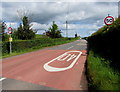
From 40 to 50 on the B4598, Llanfair Kilgeddin, Monmouthshire
The 40mph speed limit on the B4598 near the main residential part of the village increases to 50mph ahead.
Image: © Jaggery
Taken: 14 May 2017
0.05 miles
5
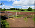
Two field gates, Llanfair Kilgeddin, Monmouthshire
On the west side of the B4598 in rural Monmouthshire.
Image: © Jaggery
Taken: 14 May 2017
0.06 miles
6
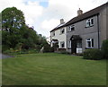
Gethin Place houses, Llanfair Kilgeddin, Monmouthshire
The name sign on the wall of the two semi-detached houses shows GETHIN PLACE.
Image: © Jaggery
Taken: 14 May 2017
0.07 miles
7
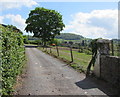
Glanusk Farm access road, Llanfair Kilgeddin, Monmouthshire
From the east side of the B4598.
Image: © Jaggery
Taken: 14 May 2017
0.07 miles
8
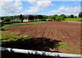
Mostly brown field, Llanfair Kilgeddin, Monmouthshire
Viewed from the gate on the left here http://www.geograph.org.uk/photo/5394623 in mid May 2017.
Image: © Jaggery
Taken: 14 May 2017
0.08 miles
9
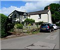
Forge Cottage, Llanfair Kilgeddin, Monmouthshire
Llanfair Kilgeddin is a small village between Usk and Abergavenny.
Image: © Jaggery
Taken: 14 May 2017
0.09 miles
10
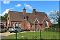
Former village primary school, Llanfair Kilgeddin
Closed in 2016, the Victorian former Church in Wales V.A. Primary School is now a private residence (or possibly two residences). Some of my ancestors and relatives attended the school in the past.
Image: © M J Roscoe
Taken: 19 May 2021
0.10 miles