IMAGES TAKEN NEAR TO
Llanddewi Rhydderch, ABERGAVENNY, NP7 9UE
Introduction
This page details the photographs taken nearby to NP7 9UE by members of the Geograph project.
The Geograph project started in 2005 with the aim of publishing, organising and preserving representative images for every square kilometre of Great Britain, Ireland and the Isle of Man.

There are currently over 7.5m images from over14,400 individuals and you can help contribute to the project by visiting https://www.geograph.org.uk
Image Map
Images are licensed for reuse under creativecommons.org/licenses/by-sa/2.0
Notes
- Clicking on the map will re-center to the selected point.
- The higher the marker number, the further away the image location is from the centre of the postcode.
Image Listing (4 Images Found)
Images are licensed for reuse under creativecommons.org/licenses/by-sa/2.0
Image
Details
Distance
1
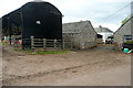
Coed Morgan Farm
Some of the many buildings at this busy farm.
Image: © Graham Horn
Taken: 13 Apr 2012
0.02 miles
2
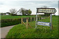
Junction north of Coed Morgan
This whole countryside seems to be green and white.
Image: © Graham Horn
Taken: 13 Apr 2012
0.07 miles
3
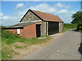
Garage & building on back road
Image: © Nick Mutton 01329 000000
Taken: 11 Sep 2007
0.12 miles
4
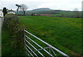
North of Coed Morgan
There are some houses dotted around, but it is mainly pasture. In the background is Ysgyryd Fawr, The Skirrid, in Image
Image: © Graham Horn
Taken: 13 Apr 2012
0.16 miles