1
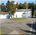
Dragon Lane, Govilon
Houses on Dragon Lane viewed from the B4246.
Image: © Jaggery
Taken: 20 Oct 2010
0.02 miles
2
Bus shelter at the eastern edge of Govilon
The bus shelter is adjacent to houses on the corner of Dragon Lane and Merthyr Road (B4246).
Image: © Jaggery
Taken: 20 Oct 2010
0.02 miles
3
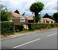
Corner of Elms Road and Merthyr Road, Govilon
The houses are near the eastern edge of Govilon.
Image: © Jaggery
Taken: 20 Oct 2010
0.02 miles
4
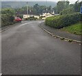
South along Elms Road, Govilon, Monmouthshire
Dead-end road viewed from the B4246.
Image: © Jaggery
Taken: 17 Sep 2023
0.04 miles
5
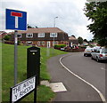
BT telecoms cabinet, The Avenue, Govilon
Located near the corner of Merthyr Road, viewed in July 2017.
The cabinet is not in a July 2011 Google Earth Street View.
The sign shows that The Avenue is Y Rhodfa in Welsh.
Image: © Jaggery
Taken: 23 Jul 2017
0.04 miles
6
Large bilingual street name sign on a Govilon corner
The English/Welsh sign faces Merthyr Road. The grey back of the sign is on the left here. http://www.geograph.org.uk/photo/5473298
Image: © Jaggery
Taken: 23 Jul 2017
0.04 miles
7
No access to canal, Govilon, Monmouthshire
Referring to Elms Road https://www.geograph.org.uk/photo/7600575 the sign facing the B4246 has English and Welsh text.
Image: © Jaggery
Taken: 17 Sep 2023
0.04 miles
8
Entrance to Ty-clyd, Govilon
This is the Merthyr Road end of a 200-metre long entrance drive to Ty-clyd, one of the oldest houses in Govilon. A part of the entrance lodge can be seen at the right edge of the view.
Image: © Jaggery
Taken: 22 Oct 2010
0.05 miles
9
Houses in The Avenue, Govilon
The houses are on the north side of, and set slightly below, the B4246 Merthyr Road.
Image: © Jaggery
Taken: 23 Jul 2017
0.06 miles
10
Along The Avenue, Govilon
The Avenue (Y Rhodfa in Welsh) leads to Maeshyfryd.
A dark green BT telecoms cabinet http://www.geograph.org.uk/photo/5473298 is in the foreground.
Image: © Jaggery
Taken: 23 Jul 2017
0.06 miles


