1
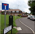
Along The Avenue, Govilon
The Avenue (Y Rhodfa in Welsh) leads to Maeshyfryd.
A dark green BT telecoms cabinet http://www.geograph.org.uk/photo/5473298 is in the foreground.
Image: © Jaggery
Taken: 23 Jul 2017
0.02 miles
2
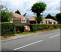
Houses in The Avenue, Govilon
The houses are on the north side of, and set slightly below, the B4246 Merthyr Road.
Image: © Jaggery
Taken: 23 Jul 2017
0.03 miles
3
BT telecoms cabinet, The Avenue, Govilon
Located near the corner of Merthyr Road, viewed in July 2017.
The cabinet is not in a July 2011 Google Earth Street View.
The sign shows that The Avenue is Y Rhodfa in Welsh.
Image: © Jaggery
Taken: 23 Jul 2017
0.04 miles
4
Large bilingual street name sign on a Govilon corner
The English/Welsh sign faces Merthyr Road. The grey back of the sign is on the left here. http://www.geograph.org.uk/photo/5473298
Image: © Jaggery
Taken: 23 Jul 2017
0.04 miles
5
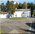
Dragon Lane, Govilon
Houses on Dragon Lane viewed from the B4246.
Image: © Jaggery
Taken: 20 Oct 2010
0.05 miles
6
Bus shelter at the eastern edge of Govilon
The bus shelter is adjacent to houses on the corner of Dragon Lane and Merthyr Road (B4246).
Image: © Jaggery
Taken: 20 Oct 2010
0.05 miles
7
Corner of Elms Road and Merthyr Road, Govilon
The houses are near the eastern edge of Govilon.
Image: © Jaggery
Taken: 20 Oct 2010
0.05 miles
8
The Avenue, Govilon
Houses on the north side of The Avenue, on the eastern edge of Govilon.
Image: © Jaggery
Taken: 22 Oct 2010
0.05 miles
9
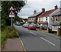
End of the pavement on the south side of Merthyr Road, Govilon
Warning signs show Road Narrows and No footway for 100 y(ar)ds.
Walkers can use the pavement on the north side of the road.
Image: © Jaggery
Taken: 23 Jul 2017
0.05 miles
10
No access to canal, Govilon, Monmouthshire
Referring to Elms Road https://www.geograph.org.uk/photo/7600575 the sign facing the B4246 has English and Welsh text.
Image: © Jaggery
Taken: 17 Sep 2023
0.07 miles


