1
Llanfoist Railway Bridge
This bridge used to form part of the Railway from Abergavenny to Brynmmawr. Work commenced on the railway in Abergavenny on the 18th June 1860, reaching Brynmawr on the 29th September 1862. Sadly, the last public service ran on Saturday June 4 1958, the very last train running was the 08.30 a.m. Abergavenny Junction to Merthyr station, hauled by an old GWR pannier tank steam train.
On Sunday 5 June 1958 a special train was laid on that summer evening, after dark, steaming uphill from Abergavenny to Merthyr to commemorate the closing of the line, the train driver was Mr. G.E. Lewis, his fireman Mr. D. Hinton and the train's guard was Mr. Hubert James, of Abergavenny.
Crowds gathered at viewpoints at the trackside along the entire route, with large crowds at Brynmawr station. The bridge now carries National cycle route number 46.
Image: © RAY JONES
Taken: 13 Jun 2009
0.04 miles
2
Houses near the western edge of Llanfoist
A short row of houses is located between the B4246 and A465 (Heads of the Valleys Road). Access to the B4246 is along a lane that passes under a short former railway bridge. http://www.geograph.org.uk/photo/2174788
Image: © Jaggery
Taken: 22 Oct 2010
0.04 miles
3
Short former railway bridge near Llanfoist
A bridge across a lane from the B4246 (ahead) to a small row of houses http://www.geograph.org.uk/photo/2174774 formerly carried the Abergavenny to Brynmawr railway lines. The bridge and railbed are now part of a combined cycleway and footpath.
Image: © Jaggery
Taken: 22 Oct 2010
0.04 miles
4
Horses in a paddock beside the Govilon to Llanfoist road
I believe that the horse with the 'dalmatian' markings may be a British spotted horse or pony, known (rather inaccurately I feel) as 'leopard-spotted', more precisely referred to as an Appaloosa horse and one of just 170 or so born every year in the UK, a genetic throwback to the markings which evolved as a natural camouflage for ponies roaming the heaths and forests of ancient Britain, and are included in several Stone Age cave paintings and on ancient historical manuscripts. During Roman times the horses were often traditionally presented to important officers as a sign of their power apparently.
Image: © Jeremy Bolwell
Taken: 30 Jul 2011
0.05 miles
5
Bridge for passage along disused railway towards Llanfoist
Image: © Peter Robinson
Taken: 22 Mar 2015
0.05 miles
6
Cycle path near Llanfoist
This was once the Merthyr, Tredegar & Abergavenny Railway.
Image: © Gareth James
Taken: 27 Nov 2010
0.05 miles
7
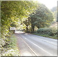
Llanfoist welcomes careful drivers
The B4246 from Govilon approaches the NW edge of Llanfoist, a village adjacent to the SW edge of Abergavenny.
Image: © Jaggery
Taken: 22 Oct 2010
0.08 miles
8
B4246 near White House Lodge
Image: © Colin Pyle
Taken: 22 Apr 2018
0.10 miles
9
Heads of the Valleys Road heading east from Cadfor
Viewed from the farm access bridge. http://www.geograph.org.uk/photo/2160492
Image: © Jaggery
Taken: 22 Oct 2010
0.10 miles
10
Monmouthshire & Brecon Canal, near Llanfoist
Image: © Gareth James
Taken: 27 Nov 2010
0.11 miles


