IMAGES TAKEN NEAR TO
Iberis Road, ABERGAVENNY, NP7 9LQ

Introduction

This page details the photographs taken nearby to Iberis Road, NP7 9LQ by members of the Geograph project.

The Geograph project started in 2005 with the aim of publishing, organising and preserving representative images for every square kilometre of Great Britain, Ireland and the Isle of Man.

There are currently over 7.5m images from over14,400 individuals and you can help contribute to the project by visiting https://www.geograph.org.uk

Image Map


Images are licensed for reuse under creativecommons.org/licenses/by-sa/2.0
Notes
  • Clicking on the map will re-center to the selected point.
  • The higher the marker number, the further away the image location is from the centre of the postcode.

Image Listing (59 Images Found)

Images are licensed for reuse under creativecommons.org/licenses/by-sa/2.0
  • ...
Image
Details
Distance
1
Llanfoist Farm from the A40
Image: © Ian S Taken: 26 May 2014
0.02 miles
2
Abergavenny - Premier Inn
Image: © Colin Park Taken: 20 Apr 2018
0.02 miles
3
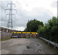
Depot at Abergavenny
The council depot at Abergavenny from the McDonald's carpark
Image: © Bill Nicholls Taken: 30 Nov 2018
0.03 miles
4
Past Abergavenny
View past Abergavenny towards the hills in the distance
Image: © Bill Nicholls Taken: 30 Nov 2018
0.04 miles
5
Grassy roundabout, Westgate, Llanfoist
Brewers Fayre is on the right. The Premier Inn on the left is being built in July 2017.
Image: © Jaggery Taken: 11 Jun 2017
0.07 miles
6
Electricity pylons near Premier Inn, Llanfoist
A Premier Inn and Brewers Fayre https://www.geograph.org.uk/photo/6140026 are in the background.
Image: © Jaggery Taken: 11 Jun 2017
0.10 miles
7
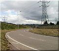
Llanfoist : Pylons and slip road from The Heads of the Valleys Road
The 450 metre long slip road from the westbound side of the A465 passes under power lines as it approaches the Merthyr Road roundabout. http://www.geograph.org.uk/photo/2186534
Image: © Jaggery Taken: 22 Oct 2010
0.11 miles
8
Transfer station direction sign, Llanfoist
On the approach to this https://www.geograph.org.uk/photo/6140026 roundabout, the sign shows that Transfer station is Gorsaf drosglwyddo in Welsh.
Image: © Jaggery Taken: 11 Jun 2017
0.11 miles
9
Entrance to Daisy Chain Nursery, Llanfoist
Children's day nursery located in Westgate Yard, set back 50 metres from the B4246 Merthyr Road. In the background is one of many electricity pylons in the Llanfoist area.
Image: © Jaggery Taken: 11 Jun 2017
0.13 miles
10
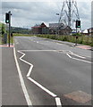
Pelican crossing on the approach to Premier Inn, Llanfoist
A Premier Inn and Brewers Fayre https://www.geograph.org.uk/photo/6140026 are in the background.
Image: © Jaggery Taken: 11 Jun 2017
0.13 miles
  • ...