IMAGES TAKEN NEAR TO
De Braose Close, ABERGAVENNY, NP7 9JJ
Introduction
This page details the photographs taken nearby to De Braose Close, NP7 9JJ by members of the Geograph project.
The Geograph project started in 2005 with the aim of publishing, organising and preserving representative images for every square kilometre of Great Britain, Ireland and the Isle of Man.

There are currently over 7.5m images from over14,400 individuals and you can help contribute to the project by visiting https://www.geograph.org.uk
Image Map
Images are licensed for reuse under creativecommons.org/licenses/by-sa/2.0
Notes
- Clicking on the map will re-center to the selected point.
- The higher the marker number, the further away the image location is from the centre of the postcode.
Image Listing (38 Images Found)
Images are licensed for reuse under creativecommons.org/licenses/by-sa/2.0
Image
Details
Distance
2
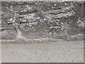
Ordnance Survey Cut Mark
This OS cut mark can be found on the wall NE side of Monmouth Road. It marks a point 61.036m above mean sea level.
Image: © Adrian Dust
Taken: 21 Aug 2023
0.03 miles
4
Plas Derwen Hotel, Abergavenny
Hotel with 11 en-suite rooms, bar and restaurant, located on the eastern side of Monmouth Road (A40), at the southern edge of Abergavenny.
Image: © Jaggery
Taken: 20 Oct 2010
0.06 miles
5
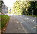
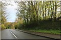
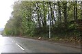
A40 approaches Abergavenny from the south
A few metres north of the roundabout at the eastern end/start of the Heads of the Valley Road (A465), the A40 approaches the historic market town of Abergavenny.
Market day is Tuesday, when the already busy central area of the town can become very busy indeed.
Image: © Jaggery
Taken: 20 Oct 2010
0.07 miles
6
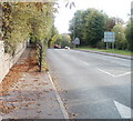
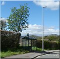
Separate pavement alongside Monmouth Road, Abergavenny
South of the Gobannium Way http://www.geograph.org.uk/photo/2125533 junction, the pavement on the east side of the road is separated from the roadway. It is heading towards Raglan Terrace.
Image: © Jaggery
Taken: 20 Oct 2010
0.07 miles
7
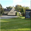
Abergavenny attractions
A large sign alongside the A40 (Monmouth Road) at the southern edge of Abergavenny indicates some of the attractions of the town: castle and museum; medieval monuments; market hall; theatre.
Image: © Jaggery
Taken: 20 Oct 2010
0.07 miles
8
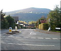
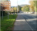
Gobannium Way, Abergavenny
Gobannium Way heads away from the west side of Monmouth Road (A40). Gobannium was a Roman fort and settlement within present-day Abergavenny.
In the distance is The Blorenge Image (561 metres or 1841 feet).
Image: © Jaggery
Taken: 20 Oct 2010
0.08 miles
9
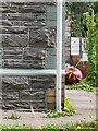
Ordnance Survey Cut Mark
This OS cut mark can be found on No4 Raglan Terrace. It marks a point 68.736m above mean sea level.
Image: © Adrian Dust
Taken: 21 Aug 2023
0.10 miles