IMAGES TAKEN NEAR TO
Nantyderry, ABERGAVENNY, NP7 9DH
Introduction
This page details the photographs taken nearby to NP7 9DH by members of the Geograph project.
The Geograph project started in 2005 with the aim of publishing, organising and preserving representative images for every square kilometre of Great Britain, Ireland and the Isle of Man.

There are currently over 7.5m images from over14,400 individuals and you can help contribute to the project by visiting https://www.geograph.org.uk
Image Map
Images are licensed for reuse under creativecommons.org/licenses/by-sa/2.0
Notes
- Clicking on the map will re-center to the selected point.
- The higher the marker number, the further away the image location is from the centre of the postcode.
Image Listing (25 Images Found)
Images are licensed for reuse under creativecommons.org/licenses/by-sa/2.0
Image
Details
Distance
1
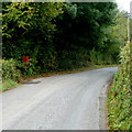
Rural postbox, Goytre
Alongside the road from Goytre to Nantyderry, near houses (Tyr Coedwigwr and Llwch Lodge).
Image: © Jaggery
Taken: 22 Sep 2011
0.04 miles
2
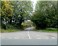
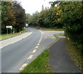
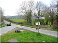
Road from Goytre to Nantyderry and Chainbridge
Viewed across the A4042. A sign arm behind the camera shows
1 mile to Nantyderry, 2 miles to Chainbridge.
Image: © Jaggery
Taken: 22 Sep 2011
0.06 miles
3
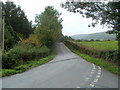
Road from Nantyderry to Goytre
Viewed from this grass triangle. http://www.geograph.org.uk/photo/3529581 The A4042 is about 400 metres ahead.
Image: © Jaggery
Taken: 22 Sep 2011
0.07 miles
4
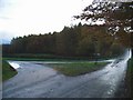
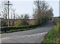
Road junction
Looking towards Llwch woods.
Image: © Jennifer Luther Thomas
Taken: 17 Nov 2006
0.09 miles
5
The northern point of Llwch
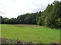
A large conifer plantation between Goytre Hall and Goytre Farm.
Image: © Christine Johnstone
Taken: 13 Sep 2013
0.10 miles
6
Goytre : junction for Nantyderry and Chainbridge
Viewed from an A4042 bus stop. The sign arm pointing right shows 1 mile to Nantyderry, 2 miles to Chainbridge.
Image: © Jaggery
Taken: 22 Sep 2011
0.10 miles
7
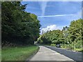
Junction near Nantyderry, Monmouthshire
Ahead for the A4042 in rural Monmouthshire.
Image: © Jaggery
Taken: 10 Apr 2022
0.11 miles
8
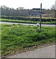
Two miles from Pantygoytre
Direction and distance sign on a grass triangle in rural Monmouthshire.
Image: © Jaggery
Taken: 10 Apr 2022
0.12 miles
9
Groesonen Road junction
Some thoughtful person has left two rubbish bags here now imortalised on Geograph.
The track to the right leads into Coed Abergwenllan.
Image: © Jonathan Billinger
Taken: 7 Apr 2010
0.12 miles
10
On the A4042 at the junction for Nantyderry and Chainbridge
Image: © Rob Purvis
Taken: 25 Sep 2023
0.12 miles