1
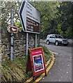
Direction sign 3 miles from Cwmyoy
The sign at a junction in Llanvihangel Crucorney (Monmouthshire)
is 3 miles from Cwmyoy, 6 from Llanthony, 2½ from a nature reserve.
The sign shows that Cwmyoy is Cwm-Iou in Welsh and Llanthony is Llanddewi Nant Hodni.
A Landmark Trust board shows that Llwyn Celyn https://www.geograph.org.uk/photo/7884590 is open today from 10am to 4pm.
Image: © Jaggery
Taken: 22 Sep 2024
0.03 miles
2
The Skirrid Inn, Llanvihangel Crucorny
Worth a visit.
Image: © Jeremy Bolwell
Taken: 17 Jan 2016
0.04 miles
3
Minor Road to Pen-y-bont and beyond
Image: © Peter Robinson
Taken: 25 Mar 2015
0.04 miles
4
The Skirrid Inn, Llanvihangel Crucorney
Image: © John Lord
Taken: 28 Aug 2020
0.04 miles
5
The Skirrid Inn
Mid - late 17th Century pub, although reputed to have much older origins, alternatively known as The Skirrid Mountain Inn. Grade II listed - see https://cadwpublic-api.azurewebsites.net/reports/listedbuilding/FullReport?lang=&id=1918.
Image: © Ian Capper
Taken: 21 Feb 2022
0.05 miles
6
SMG in Llanvihangel Crucorney
SMG (Skirrid Mountain Garage) is a convenience store, filling station and car sales business. http://www.geograph.org.uk/photo/3846103
The Skirrid Inn http://www.geograph.org.uk/photo/3846101 is on the right.
Image: © Jaggery
Taken: 19 Feb 2012
0.05 miles
7
The Skirrid Inn, Llanfihangel Crucorney
The public house or inn at the junction of the old Abergavenny to Hereford road with the road from the Llanthony Valley, or Vale of Ewyas as it is also known, is recorded in medieval literature dating from 1110 AD, making it one of the oldest recorded roadside inns in Wales. Its name comes from the nearby mountain, the Skirrid, or Ysgyryd Fawr, a few kilometres to the south.
Image: © Jeremy Bolwell
Taken: 31 May 2011
0.05 miles
8
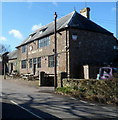
Castellated stone building in Llanvihangel Crucorney, Monmouthshire
Image: © Jaggery
Taken: 22 Sep 2024
0.06 miles
9
View of the village nr the Church
A garage and Pub , many villages have lost both. Pleasant afternoon sun highlights this pleasant village which is by passed from the main road.
Image: © roger geach
Taken: 1 Sep 2012
0.06 miles
10
The Skirrid Inn, Llanvihangel Crucorney
The Skirrid Inn is in north Monmouthshire, 5 miles north of Abergavenny and 18 miles from Hereford. It is reputed to be the oldest public house in Wales with a history dating from c1100.
Image: © Jaggery
Taken: 19 Feb 2012
0.06 miles


