1
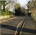
Abergavenny Cricket Club, Avenue Road
A match is in progress here and a spectator has a great vantage point looking out at a pretty idyllic setting with the Deri hill behind.
Image: © Jeremy Bolwell
Taken: 31 Aug 2013
0.07 miles
2
Pen-y-pound Court, Abergavenny
Pen-y-pound Court is a cul-de-sac of 9 houses on the west side of a road named Pen-y-pound.
Image: © Jaggery
Taken: 7 Dec 2011
0.07 miles
3
Baptist Academy 1807 plaque, Abergavenny
The plaque is on the wall of this Pen-y-pound house. http://www.geograph.org.uk/photo/2801395
It records:
TO THE GLORY OF GOD
IN THIS HOUSE IN 1807 REV MICAH THOMAS ESTABLISHED AN ACADEMY FOR TRAINING BAPTIST MINISTERS NOW THE SOUTH WALES BAPTIST COLLEGE, CARDIFF.
THIS MARKED THE BEGINNING OF MODERN BAPTIST MINISTERIAL TRAINING
Image: © Jaggery
Taken: 7 Dec 2011
0.13 miles
4
Western side of Pen-y-pound Stadium, Abergavenny
Pen-y-pound Stadium is the home ground of Abergavenny Thursdays AFC (Association Football Club). The first football club in Abergavenny, in the 1890s, was named Abergavenny Rangers. Early in the 20th century, the club was renamed Abergavenny Rangers Thursdays. The current name, Abergavenny Thursdays Football Club, was adopted in 1908.
The "Thursdays" part of their name is said to have been used because Thursday was half-day closing in Abergavenny, allowing the players (mostly apprentices, shopboys and other local workers) to be available for matches in the afternoon. But if the team was named because it was unusual to play football on Thursday (rather than the usual Saturday), against whom did they play?
Image: © Jaggery
Taken: 7 Dec 2011
0.13 miles
5
Entrance to Abergavenny Tennis Club
Located at 40, Pen-y-pound opposite Pen-y-pound Stadium. http://www.geograph.org.uk/photo/2799795
Image: © Jaggery
Taken: 7 Dec 2011
0.13 miles
6
Baptist Academy founded here in 1807, Abergavenny
A plaque http://www.geograph.org.uk/photo/2801410 on the wall of this Pen-y-pound house records that it was here that modern Baptist ministerial training began with the establishment of an academy in 1807.
Image: © Jaggery
Taken: 7 Dec 2011
0.13 miles
7
Pen-y-pound houses, Abergavenny
The houses are on the west side of Pen-y-pound, facing Pen-y-pound Stadium, http://www.geograph.org.uk/photo/2799795 the home ground of Abergavenny Thursdays Football Club.
Image: © Jaggery
Taken: 7 Dec 2011
0.13 miles
8
Ordnance Survey Cut Mark
This OS cut mark can be found on No28 Hill Road. It marks a point 68.562m above mean sea level.
Image: © Adrian Dust
Taken: 3 Jul 2020
0.13 miles
9
Harold Road towards Avenue Road, Abergavenny
Looking to the ENE past school railings on the right.
Image: © Jaggery
Taken: 29 Dec 2019
0.14 miles
10
Pen-y-pound descends past an entrance to The Hill
The left turn is an entrance http://www.geograph.org.uk/photo/2799639 to a former campus of Coleg Gwent.
Image: © Jaggery
Taken: 7 Dec 2011
0.15 miles


