IMAGES TAKEN NEAR TO
Llanwenarth, ABERGAVENNY, NP7 7EU

Introduction

This page details the photographs taken nearby to NP7 7EU by members of the Geograph project.

The Geograph project started in 2005 with the aim of publishing, organising and preserving representative images for every square kilometre of Great Britain, Ireland and the Isle of Man.

There are currently over 7.5m images from over14,400 individuals and you can help contribute to the project by visiting https://www.geograph.org.uk

Image Map


Images are licensed for reuse under creativecommons.org/licenses/by-sa/2.0
Notes
  • Clicking on the map will re-center to the selected point.
  • The higher the marker number, the further away the image location is from the centre of the postcode.

Image Listing (11 Images Found)

Images are licensed for reuse under creativecommons.org/licenses/by-sa/2.0
Image
Details
Distance
1
Lane south from The Steps, A40 near Abergavenny
The Steps is a farm set slightly above road level, behind the camera. Ahead, a lane heads south from the A40 in the direction of Llanwenarth.
Image: © Jaggery Taken: 19 Jun 2011
0.08 miles
2
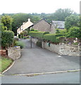
Entrance drive to Glan Hyfryd near Abergavenny
This is the A40 end of a 150-metre long drive to a house on the north side of the road, to the west of Abergavenny.
Image: © Jaggery Taken: 19 Jun 2011
0.09 miles
3
Entrance drive to Grey Hall near Abergavenny
View across the A40, to the west of Abergavenny.
Image: © Jaggery Taken: 19 Jun 2011
0.13 miles
4
Lane at Llanwenarth
Looking west; high ground at the foot of Y Fal to the right.
Image: © Jonathan Billinger Taken: 10 Jun 2016
0.17 miles
5
Lower House
Private drive off the Llanwenarth road on the Usk valley floor.
Image: © Jonathan Billinger Taken: 10 Jun 2016
0.18 miles
6
Farm building near Llanwenarth
Viewed from the south side of the A40, to the west of Abergavenny. The distant peak is the Blorenge Image summit 561 metres (1,841 feet).
Image: © Jaggery Taken: 19 Jun 2011
0.18 miles
7
Hillside view from Llanwenarth Citra, Monmouthshire
Looking to the NNW from these https://www.geograph.org.uk/photo/6438838 field gates.
Image: © Jaggery Taken: 29 Dec 2019
0.18 miles
8
Grey Hall Cottage near Abergavenny
Located west of Abergavenny, on the north side of the A40.
Image: © Jaggery Taken: 19 Jun 2011
0.20 miles
9
Farmland near Llanwenarth
With the slopes of Sugar Loaf rising behind.
Image: © Stuart Wilding Taken: 28 May 2007
0.21 miles
10
Usk flood plain
Rich pasture of the valley floor at llanwenarth.
Image: © Jonathan Billinger Taken: 10 Jun 2016
0.21 miles