1
Welsh language primary school, Mardy
Ysgol Gymraeg Y Fenni is located on St David's Road in the village of Mardy, on the north side of Abergavenny. The school, for children aged 4 to 11, conducts lessons in Welsh.
Image: © Jaggery
Taken: 1 Sep 2011
0.11 miles
2
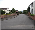
Charles Close, Abergavenny
Viewed from Llwynu Lane. Houses in the SW corner of Charles Close are separately named - Skirrid View. They do indeed have a view of The Skirrid (peak 486m or 1,594 ft), seen here in the background.
Image: © Jaggery
Taken: 7 Dec 2011
0.12 miles
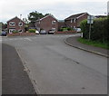
3
Charles Crescent, Abergavenny
This view from Llwynu Lane shows The Skirrid
Image in the background.
Image: © Jaggery
Taken: 7 Dec 2011
0.12 miles
4
Llantilio Pertholey Community Hall, Mardy
Located on the NE side of St David's Road, Mardy. The hall is owned by Llantilio Pertholey Community Council, and is used by locals for a wide variety of activities. These include Bingo Club, Buzzy Bees Mothers & Toddlers, Cardiac Rehabilitation Group, Llantilio Pertholey Women's Institute, Llantilio Pertholey Village Produce Association, Mardy Indoor Short Mat Bowls, Mardy Bridge Club, Aerobics, Martial Arts, Abergavenny Art Group and Women of The World Church Group.
Image: © Jaggery
Taken: 1 Sep 2011
0.14 miles
5
South along Firs Road, Mardy
From Poplars Road, Firs Road leads to Midway Lane and Gwent Road.
Image: © Jaggery
Taken: 7 Aug 2017
0.14 miles
6
Firs Road houses, Mardy
At the northern end of Firs Road, viewed from Poplars Road.
Image: © Jaggery
Taken: 7 Aug 2017
0.16 miles
7
South side of Poplars Road, Mardy
Viewed from the corner of Poplars Close. The bilingual (English/Welsh) sign shows 41-53 (ODDS/ODRIFAU)
Image: © Jaggery
Taken: 7 Aug 2017
0.17 miles
8
Deri View houses, Abergavenny
Viewed from Llwynu Lane.
Image: © Jaggery
Taken: 7 Dec 2011
0.17 miles
9
Brick houses, Poplars Road, Mardy
On the south side of Poplars Road near the Hillgrove Avenue junction.
Image: © Jaggery
Taken: 7 Aug 2017
0.17 miles
10
Junction of Hillgrove Avenue and Poplars Road, Mardy
Towards Poplars Road from Hillgrove Avenue.
Image: © Jaggery
Taken: 7 Aug 2017
0.18 miles


