1
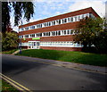
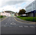
Steps up to Abergavenny Jobcentre Plus
From Tudor Street to three-storey Newbridge House.
Image: © Jaggery
Taken: 30 Sep 2018
0.01 miles
2
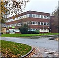
Jobcentre Plus, Tudor Street, Abergavenny
In three-storey Newbridge House on the corner of Baker Street.
Image: © Jaggery
Taken: 30 Sep 2018
0.01 miles
3
Abergavenny Jobcentre Plus
Viewed across Tudor Street in November 2023.
Image: © Jaggery
Taken: 12 Nov 2023
0.01 miles
4
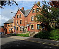
Baker Street houses, Abergavenny
The short row of houses is located between Tudor Street and Trinity Street.
Image: © Jaggery
Taken: 7 Dec 2011
0.01 miles
5
Grade II listed Church of the Holy Trinity, Abergavenny
This is the Baker Street side of the Church in Wales church, in the Diocese of Monmouth.
Holy Trinity Church was consecrated by the Bishop of Llandaff on November 6th 1840.
It was built as a chapel to serve the adjacent almshouses and the nearby school.
Grade II listed in 1974.
Image: © Jaggery
Taken: 7 Dec 2011
0.01 miles
6
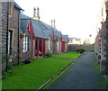
Grade II listed Trinity Almshouses, Abergavenny
This is one of two rows of almshouses inside the grounds of Holy Trinity church. http://www.geograph.org.uk/photo/2723503
This row is on the SW side of the church. The other row is parallel to it on the NE side of the church.
Grade II listed in January 1974.
Image: © Jaggery
Taken: 7 Dec 2011
0.01 miles
7
Eastern side of Grade II listed Church of the Holy Trinity, Abergavenny
A view of the church http://www.geograph.org.uk/photo/2723503 looking towards Baker Street.
Image: © Jaggery
Taken: 7 Dec 2011
0.01 miles
8
Part of Tudor Street, Abergavenny
In the late 1950's and early 1960's 'far-sighted' town planners decided to demolish old buildings in this area, many with medieval origins, and install instead a 'civic centre' style boulevard with government offices and civic buildings sited along it. Here we see a part of the magistrate's courts on the right (a building with plenty of empty, useless space under it) and the job centre which also housed a tax office above it, I believe (another shoe box building of tiny charm). Thanks.
Grrrr. They are all retired, knighted or OBE / CBE'd or gone to the planning meeting in the sky now I expect. Mutter, mutter, grumble, grumble.
At least the Sugar Loaf still looks impossibly beautiful...
Image: © Jeremy Bolwell
Taken: 29 May 2012
0.02 miles
9
Tudor Street houses, Abergavenny
Located near the corner of Pant Lane, the houses are opposite Linda Vista Gardens.
Image: © Jaggery
Taken: 30 Sep 2018
0.02 miles
10
North along Baker Street, Abergavenny
From Tudor Street.
Image: © Jaggery
Taken: 30 Sep 2018
0.03 miles


