IMAGES TAKEN NEAR TO
Grofields, Victoria Street, ABERGAVENNY, NP7 5DQ

Introduction

This page details the photographs taken nearby to Grofields, Victoria Street, NP7 5DQ by members of the Geograph project.

The Geograph project started in 2005 with the aim of publishing, organising and preserving representative images for every square kilometre of Great Britain, Ireland and the Isle of Man.

There are currently over 7.5m images from over14,400 individuals and you can help contribute to the project by visiting https://www.geograph.org.uk

Image Map


Images are licensed for reuse under creativecommons.org/licenses/by-sa/2.0
Notes
  • Clicking on the map will re-center to the selected point.
  • The higher the marker number, the further away the image location is from the centre of the postcode.

Image Listing (501 Images Found)

Images are licensed for reuse under creativecommons.org/licenses/by-sa/2.0
  • ...
Image
Details
Distance
1
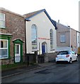
Salvation Army Hall, Victoria Street, Abergavenny
Located near the Regent Street junction. An inscription on a stone plaque above the windows records that this was originally Tabernacle Primitive Methodist Chapel, erected in 1850.
Image: © Jaggery Taken: 7 Dec 2011
0.01 miles
2
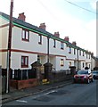
Victoria Street houses, Abergavenny
Looking west from near the corner of Regent Street.
Image: © Jaggery Taken: 7 Dec 2011
0.01 miles
3
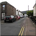
Prospect Road, Abergavenny
There is one-way traffic along narrow Prospect Road. Viewed from Pant Lane looking in the direction of Regent Street.
Image: © Jaggery Taken: 7 Dec 2011
0.01 miles
4
Victoria Street, Abergavenny
The houses are on the north side of Victoria Street.
Image: © Jaggery Taken: 15 Jul 2012
0.02 miles
5
Victoria Street
1840s/50s housing in Victoria Street.
Image: © Ian Capper Taken: 9 Sep 2021
0.02 miles
6
Victoria Street
1840s/50s housing in Victoria Street.
Image: © Ian Capper Taken: 9 Sep 2021
0.02 miles
7
Ordnance Survey Cut Mark
This OS cut mark can be found at the junction of Pant Lane & Victoria Street. It marks a point 61.387m above mean sea level.
Image: © Adrian Dust Taken: 4 Jun 2014
0.03 miles
8
South along Regent Street, Abergavenny
From opposite the Princes Street junction along Regent Street towards Victoria Street.
Image: © Jaggery Taken: 30 Sep 2018
0.04 miles
9
Salvation Army citadel
Salvation Army citadel in Victoria Street, built originally as a Primitive Methodist chapel. The date plaque reads 1850. Grade II listed - see https://cadwpublic-api.azurewebsites.net/reports/listedbuilding/FullReport?lang=&id=2473 (note that the listing details suggest a building year of 1830, although this is contradicted by the chapel not being marked on the 1844 tithe map).
Image: © Ian Capper Taken: 9 Sep 2021
0.04 miles
10
Victoria Street
1840s/50s housing in Victoria Street.
Image: © Ian Capper Taken: 9 Sep 2021
0.04 miles
  • ...