1
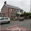
Crickhowell Road semis, Gilwern
Semi-detached houses on the east side of Crickhowell Road
between the Bank Crescent junction and the Glangrwyney Road junction.
Image: © Jaggery
Taken: 20 Aug 2017
0.01 miles
2
Speed camera warning sign, Crickhowell Road, Gilwern
The sign is on a Crickhowell Road lamppost near the corner of Bank Crescent.
The speed limit on the A4077 Crickhowell Road dropped from the National Speed Limit
to 30mph a few tens of metres behind the camera, at the northwest edge of the village.
Image: © Jaggery
Taken: 20 Aug 2017
0.02 miles
3
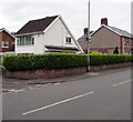
Bank Crescent, Gilwern
Cul-de-sac viewed across the A4077 Crickhowell Road.
Image: © Jaggery
Taken: 20 Aug 2017
0.02 miles
4
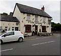
The Corn Exchange, Gilwern
Image: © Ian S
Taken: 23 May 2014
0.02 miles
5
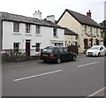
Penybont Cottage, Crickhowell Road, Gilwern
Penybont Cottage on the left, Corn Exchange pub http://www.geograph.org.uk/photo/5508327 on the right.
Image: © Jaggery
Taken: 20 Aug 2017
0.02 miles
6
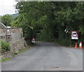
Southern end of Glangrwyney Road, Gilwern
A permanent sign shows that the 30mph speed limit increases to the National Speed Limit ahead.
In August 2017, temporary signs show Single file traffic and a 7.5 tonnes vehicle weight limit, except for access.
Glangrwyney is about a mile (1.6km) ahead. The A4077 Crickhowell Road is behind the camera.
Image: © Jaggery
Taken: 20 Aug 2017
0.03 miles
7
South side of the Corn Exchange, Gilwern
The Glangrwyney Road side of the pub on the corner of Crickhowell Road. http://www.geograph.org.uk/photo/5505903 to the name sign.
Image: © Jaggery
Taken: 20 Aug 2017
0.03 miles
8
Corn Exchange, Gilwern
Pub on the corner of the A4077 Crickhowell Road and Glangrwyney Road
(ahead on the right), viewed from the corner of Church Road.
Image: © Jaggery
Taken: 13 Aug 2017
0.03 miles
9
Corn Exchange name sign, Gilwern
Hanging from a wall bracket here. http://www.geograph.org.uk/photo/5505895
Image: © Jaggery
Taken: 20 Aug 2017
0.03 miles
10
Open Mic day at the Corn Exchange, Gilwern
Viewed across the A4077 Crickhowell Road. The board outside the pub entrance shows that today, a Sunday, is Open Mic(rophone) day from 3pm-5pm, when all styles of music are welcome in a friendly pub atmosphere.
Image: © Jaggery
Taken: 20 Aug 2017
0.03 miles


