IMAGES TAKEN NEAR TO
Garn Yr Erw, Blaenavon, PONTYPOOL, NP4 9SJ

Introduction

This page details the photographs taken nearby to NP4 9SJ by members of the Geograph project.

The Geograph project started in 2005 with the aim of publishing, organising and preserving representative images for every square kilometre of Great Britain, Ireland and the Isle of Man.

There are currently over 7.5m images from over14,400 individuals and you can help contribute to the project by visiting https://www.geograph.org.uk

Image Map


Images are licensed for reuse under creativecommons.org/licenses/by-sa/2.0
Notes
  • Clicking on the map will re-center to the selected point.
  • The higher the marker number, the further away the image location is from the centre of the postcode.

Image Listing (75 Images Found)

Images are licensed for reuse under creativecommons.org/licenses/by-sa/2.0
  • ...
Image
Details
Distance
1
Waun-Mary-Gunter, Whistle Road
Farm at the end of Whistle Road with Cefn Coch rising behind.
Image: © M J Roscoe Taken: 6 Jan 2023
0.03 miles
2
Gate to common land beyond the southern end of Whistle Road, Garn-yr-erw
A signpost shows a public footpath across the common http://www.geograph.org.uk/photo/4484097 The red notice on the left shows NO DRIVING ON THE COMMON WITHOUT LAWFUL AUTHORITY.
Image: © Jaggery Taken: 14 Sep 2013
0.06 miles
3
Landscape above Blaenafon
Upland marsh grasses blow in the cold westerly wind and some sunshine plays along the old spoil heaps on the valley side above.
Image: © Jeremy Bolwell Taken: 9 Dec 2012
0.07 miles
4
Towards the southern end of Whistle Road
This gravelly end of the road is private and turns to the left to Waun-Mary-Gunter. The derelict Field Farm buildings are on the right. Cefn Coch is in the background. There is a public footpath on this section of the road; at the corner the path ascends the hillside.
Image: © M J Roscoe Taken: 6 Jan 2023
0.08 miles
5
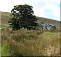
The ruined Field Farm
Image: © Gareth James Taken: 12 Sep 2015
0.08 miles
6
Disused farm west of Garn-yr-erw
Looking west on an autumn day.
Image: © Andrew Jones Taken: 30 Oct 2007
0.08 miles
7
The rear of ruined Field Farm
The roof is shot.
Image: © Jeremy Bolwell Taken: 9 Dec 2012
0.08 miles
8
Unofficial 5mph speed limit along the southern end of Whistle Road, Garn-yr-erw
A non-standard sign showing 5 MPH is on the post on the right. The road ends at the edge of moorland ahead.
Image: © Jaggery Taken: 14 Sep 2013
0.08 miles
9
Derelict Field Farm off Whistle Road
Ruined farm buildings near the end of Whistle Road.
Image: © M J Roscoe Taken: 2 Jan 2023
0.09 miles
10
Derelict buildings near the southern end of Whistle Road, Garn-yr-erw
Image: © Jaggery Taken: 14 Sep 2013
0.09 miles
  • ...