1
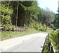
Two cottages near a bend on Cwmavon Road
The cottages are on the south side of this http://www.geograph.org.uk/photo/2921229 bend on Cwmavon Road, between Blaenavon to the NW and Cwmavon to the SE.
Image: © Jaggery
Taken: 28 Apr 2011
0.07 miles
2
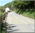
Bend in Cwmavon Road near two cottages
Signs showing black and white arrows alert drivers to a bend ahead on the A4043 (Cwmavon Road).
Two semi-detached cottages http://www.geograph.org.uk/photo/2921214 are a few metres beyond the bend.
Image: © Jaggery
Taken: 28 Apr 2011
0.07 miles
3
Yellow road markings on Cwmavon Road approaching a bend
Behind the camera, a sign shows a 30mph speed limit ahead on the approach to a bend in the road beyond the cottages. http://www.geograph.org.uk/photo/2921214 The yellow grid painted on the road surface is presumably intended to reinforce the "hazard ahead" message.
Image: © Jaggery
Taken: 28 Apr 2011
0.07 miles
4
Afon Lwyd viewed from Cwmavon Road near two cottages
A glimpse of the river from the A4043 (Cwmavon Road) a few tens of metres SE of these cottages. http://www.geograph.org.uk/photo/2921214
Image: © Jaggery
Taken: 28 Apr 2011
0.10 miles
5
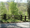
No public footpath to the river valley from here, north of Cwmavon
A Torfaen County Borough notice on the gate at the side of Cwmavon Road states, in English and Welsh, that there is no public footpath (to the valley of the Afon Lwyd).
Image: © Jaggery
Taken: 28 Apr 2011
0.12 miles
6
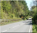
Bend and 30mph speed limit ahead, Cwmavon Road north of Cwmavon
On its descent from Blaenavon to Cwmavon, the speed limit ahead reduces from 40mph to 30mph through a bendy section of road. The first bend is about 100 metres ahead.
Image: © Jaggery
Taken: 28 Apr 2011
0.12 miles
7
Tourist information sign SE of Blaenavon
Several hundred metres yet from the SE boundary http://www.geograph.org.uk/photo/2852495 of Blaenavon, a large sign lists the attractions to be found in the heritage town.
Image: © Jaggery
Taken: 28 Apr 2011
0.12 miles
8
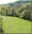
River meadow between Blaenavon and Cwmavon
Viewed from Cwmavon Road. The meadow is on the bank of the Afon Lwyd, the course of which is tree-lined.
Image: © Jaggery
Taken: 28 Apr 2011
0.12 miles
9
Steep and wooded side of the river
Image: © Carol Rose
Taken: 16 Jun 2007
0.15 miles
10
Gated track up from Afon Lwyd Trail
The track originates at Ty Rhodd Farm in the valley to the right and come up to a gate on the right of the Trail.
Image: © M J Roscoe
Taken: 6 Jan 2023
0.16 miles


