1
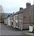
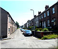
C Row houses, Forgeside, Blaenavon
The houses were built in 1850s for workers at the nearby ironworks and pits.
Row D and Row E http://www.geograph.org.uk/photo/2850333 survive, but A Row and B Row were demolished in the 1970s.
Image: © Jaggery
Taken: 15 Apr 2011
0.02 miles
2
Forgeside Village Sheep
Sheep nibbling grass and posing for the camera in Forgeside village.
Image: © David Roberts
Taken: 21 Feb 2009
0.02 miles
3
Forgeside Bus Stop
A bus stop by terraced houses in Forgeside, on the last day the bus service was operated by Stagecoach.
Image: © David Roberts
Taken: 21 Feb 2009
0.03 miles
4
Disused electricity power house, C Row
Former power house built about 1920 for nearby ironworks, Forge Side. Compare with
Image in 2011.
Image: © M J Roscoe
Taken: 6 Jan 2023
0.04 miles
5
Industrial area, Forgeside, Blaenavon
A view through the fence, from a bend in Forge Road.
Industrial buildings extend for about 600 metres on the north side of the residential area of Forgeside.
Image: © Jaggery
Taken: 15 Apr 2011
0.04 miles
6
Part of the industrial area, Forgeside, Blaenavon
A fenced-off area of industrial buildings extends for about 600 metres on the north side of the residential area of Forgeside. This small section, viewed from Forge Road, includes the entrance to the "large rings machine shop".
Image: © Jaggery
Taken: 15 Apr 2011
0.04 miles
7
Single track railway line viewed from a weak bridge, Forgeside Road
The view NW along the heritage Pontypool & Blaenavon Railway route, from a weak bridge. http://www.geograph.org.uk/photo/2363712
Image: © Jaggery
Taken: 15 Apr 2011
0.06 miles
8
D row and E row houses, Forgeside
The rows of houses are named, not the street. D Row is on the left, E Row is on the right.
Image: © Jaggery
Taken: 22 Jul 2012
0.07 miles
9
Former Electrical Generating Station at Forgeside, Blaenavon
This building was once an electrical generating station, a cooling water pond lies immediately to the west. Any information regarding this building and its former use welcome.
Image: © David Bowie
Taken: 23 Jun 2005
0.07 miles
10
East side of Griffiths Court, Forgeside, Blaenavon
The houses are built on the site of A Row, demolished in the 1970s. A Row was one of five rows of houses built in the 1850s for workers at the nearby ironworks and pits. B Row was demolished at the same time, but C Row http://www.geograph.org.uk/photo/2850617 D Row and E Row http://www.geograph.org.uk/photo/2850333 survive.
Image: © Jaggery
Taken: 15 Apr 2011
0.07 miles


